Earthquake 5 km NNW of Boron, CA
Wed, 18 Feb 2026 00:14:49 GMT
Time10 hours ago
Location
35.0375, -117.6720
Depth
-0.6 KM
Event Summary
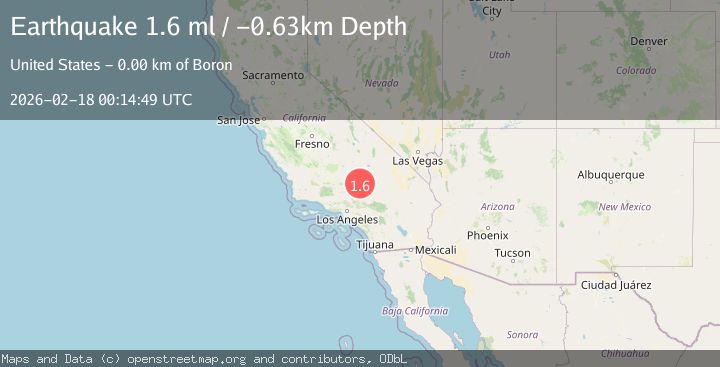
A 1.6 magnitude earthquake struck on 5 km NNW of Boron, CA, at Wed, 18 Feb 2026 00:14:49 GMT. Depth: -0.63km. Reviewed by USGS seismologists, this minor quake occurred at a magnitude type of ml.
Magnitude
1.6
ml
Source
USGS
Intensity
-
Agency Reports
1 Sources| Source | Magnitude | Depth | Time |
|---|---|---|---|
| USGSPrimary | 1.6 | -1 km | 10 hours ago |
Earthquake Details
AutomaticEvent IDusgs_ci41187335
Tsunami PotentialNo
Magnitude Typeml
Nearest Places
- Western Mine0.5 km
- Baker0.7 km
- Baker Mine1.0 km
- Jennifer Mine1.5 km
- Gephart Junior High School1.5 km
Comments
Join the discussion about this event.
Latest Earthquakes
1.2Mag
Central Alaska
Time9 hours ago
Depth72.27 km
SourceVYT (Automatic)
3.9Mag
Fox Islands, Aleutian Islands, Alaska
Time9 hours ago
Depth10.00 km
SourceVYT (Automatic)
2.5Mag
Kodiak Island region, Alaska
Time9 hours ago
Depth3.91 km
SourceVYT (Automatic)
2.0Mag
Antofagasta, Chile
Time9 hours ago
Depth144.41 km
SourceVYT (Automatic)
3.0Mag
Kenai Peninsula, Alaska
Time9 hours ago
Depth76.66 km
SourceVYT (Automatic)
Nearby Earthquakes
1.2Mag
5 km NNW of Boron, CA
Time2 days ago
Depth-0.36 km
SourceUSGS (Automatic)
1.7Mag
5 km NW of Boron, CA
Time2 weeks ago
Depth-0.78 km
SourceUSGS (Automatic)
2.1Mag
Southern California
Time1 week ago
Depth10.74 km
SourceVYT (Automatic)
2.0Mag
18 km WSW of Johannesburg, CA
Time2 weeks ago
Depth8.63 km
SourceUSGS (Automatic)
1.8Mag
18 km WSW of Johannesburg, CA
Time3 weeks ago
Depth8.04 km
SourceUSGS (Automatic)