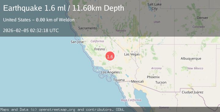
Earthquake 20 km ESE of Wofford Heights, CA
Thu, 05 Feb 2026 02:29:13 GMT
Time1 hour ago
Location
35.6388, -118.2533
Depth
9.9 KM
Event Summary
A 1.6 magnitude earthquake struck on 20 km ESE of Wofford Heights, CA, at Thu, 05 Feb 2026 02:29:13 GMT. Depth: 9.9399995803833km. Reviewed by USGS seismologists, this minor quake occurred at a magnitude type of ml.
Magnitude
1.6
ml
Source
USGS
Intensity
-
Agency Reports
1 Sources| Source | Magnitude | Depth | Time |
|---|---|---|---|
| USGSPrimary | 1.6 | 12 km | 1 hour ago |
Earthquake Details
AutomaticEvent IDusgs_ci41392016
Tsunami PotentialNo
Magnitude Typeml
Nearest Places
- Short Canyon0.8 km
- Short Canyon Well1.7 km
- Nicoll Spring2.5 km
- Brown Spring2.7 km
- Kelso Creek2.8 km
Comments
Join the discussion about this event.
Latest Earthquakes
1.4Mag
108 km S of McCarthy, Alaska
Time2 minutes ago
Depth17.30 km
SourceUSGS (Automatic)
1.5Mag
SWITZERLAND
Time9 minutes ago
Depth2.50 km
SourceETHZ (Automatic)
2.6Mag
SAN JUAN, ARGENTINA
Time20 minutes ago
Depth95.00 km
SourceNSNA (Automatic)
2.3Mag
Sulawesi, Indonesia
Time20 minutes ago
Depth3.69 km
SourceBMKG (Automatic)
3.7Mag
LUZON, PHILIPPINES
Time30 minutes ago
Depth10.00 km
SourcePIVS (Automatic)
Nearby Earthquakes
0.6Mag
12 km NNE of Kernville, CA
Time1 week ago
Depth11.44 km
SourceUSGS (Automatic)
1.1Mag
17 km W of Johannesburg, CA
Time4 days ago
Depth-0.33 km
SourceUSGS (Automatic)
1.4Mag
5 km N of Little Lake, CA
Time18 hours ago
Depth2.51 km
SourceUSGS (Automatic)
1.6Mag
15 km W of Johannesburg, CA
Time1 week ago
Depth2.45 km
SourceUSGS (Automatic)
1.4Mag
16 km W of Johannesburg, CA
Time1 week ago
Depth5.64 km
SourceUSGS (Automatic)