Earthquake 10 km NE of Indio, CA
Sat, 14 Feb 2026 09:51:32 GMT
Time5 days ago
Location
33.7775, -116.1367
Depth
7.3 KM
Event Summary
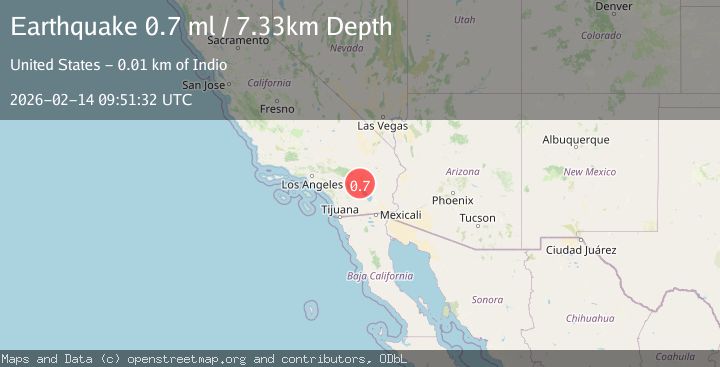
A 0.7 magnitude earthquake struck on 10 km NE of Indio, CA, at Sat, 14 Feb 2026 09:51:32 GMT. Depth: 7.33km. Reviewed by USGS seismologists, this minor quake occurred at a magnitude type of ml.
Magnitude
0.7
ml
Source
USGS
Intensity
-
Agency Reports
1 Sources| Source | Magnitude | Depth | Time |
|---|---|---|---|
| USGSPrimary | 0.7 | 7 km | 5 days ago |
Earthquake Details
AutomaticEvent IDusgs_ci41397848
Tsunami PotentialNo
Magnitude Typeml
Nearest Places
- Indio Canyon2.7 km
- Fargo Canyon4.5 km
- Dillon Road Pit4.7 km
- Berdoo4.8 km
- East Side Detention Dike Number 2 Dam6.0 km
Comments
Join the discussion about this event.
Latest Earthquakes
1.9Mag
Southeastern Alaska
Time8 minutes ago
Depth7.08 km
SourceVYT (Automatic)
2.4Mag
CENTRAL TURKEY
Time8 minutes ago
Depth9.60 km
SourceKOERI (Automatic)
1.3Mag
Central Alaska
Time9 minutes ago
Depth116.58 km
SourceVYT (Automatic)
1.7Mag
STRAIT OF GIBRALTAR
Time14 minutes ago
Depth1.00 km
SourceIGN (Automatic)
3.7Mag
Antofagasta, Chile
Time15 minutes ago
Depth123.17 km
SourceVYT (Automatic)
Nearby Earthquakes
3.0Mag
SOUTHERN CALIFORNIA
Time10 years ago
Depth5.00 km
SourceNEIR (Automatic)
0.6Mag
10 km NNE of Indio, CA
Time3 days ago
Depth7.79 km
SourceUSGS (Automatic)
1.8Mag
14 km NE of Indio, CA
Time3 weeks ago
Depth2.39 km
SourceUSGS (Automatic)
3.0Mag
SOUTHERN CALIFORNIA
Time7 months ago
Depth1.90 km
SourceSCSN (Automatic)
3.0Mag
SOUTHERN CALIFORNIA
Time11 months ago
Depth12.50 km
SourceNEIC (Automatic)