Earthquake 8 km NE of Aguanga, CA
Wed, 25 Feb 2026 01:08:07 GMT
Time1 hour ago
Location
33.4850, -116.7967
Depth
9.7 KM
Event Summary
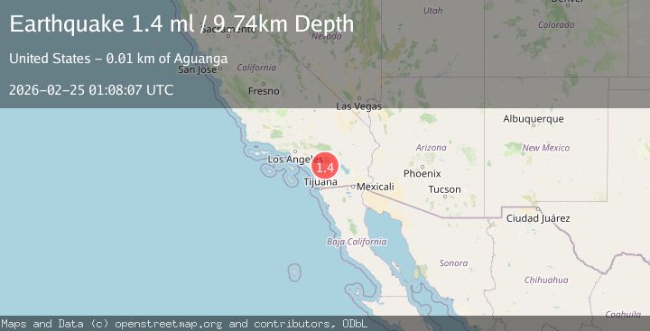
A 1.4 magnitude earthquake struck on 8 km NE of Aguanga, CA, at Wed, 25 Feb 2026 01:08:07 GMT. Depth: 9.73999977111816km. Reviewed by USGS seismologists, this minor quake occurred at a magnitude type of ml.
Magnitude
1.4
ml
Source
USGS
Intensity
-
Agency Reports
1 Sources| Source | Magnitude | Depth | Time |
|---|---|---|---|
| USGSPrimary | 1.4 | 10 km | 1 hour ago |
Earthquake Details
AutomaticEvent IDusgs_ci41403152
Tsunami PotentialNo
Magnitude Typeml
Nearest Places
- 1.3 km
- 2.4 km
- 2.5 km
- 3.1 km
- 3.5 km
Comments
Join the discussion about this event.
Latest Earthquakes
3.6Mag
off the coast of Valparaiso, Chile
Time1 hour ago
Depth0.00 km
SourceVYT (Automatic)
1.2Mag
7 km NW of The Geysers, CA
Time1 hour ago
Depth2.55 km
SourceUSGS (Automatic)
2.9Mag
Tarapaca, Chile
Time1 hour ago
Depth110.35 km
SourceVYT (Automatic)
2.2Mag
Northern Sumatra, Indonesia
Time1 hour ago
Depth5.00 km
SourceBMKG
2.2Mag
Tarapaca, Chile
Time1 hour ago
Depth90.58 km
SourceVYT (Automatic)
Nearby Earthquakes
3.0Mag
SOUTHERN CALIFORNIA
Time7 years ago
Depth6.00 km
SourceNEIC (Automatic)
3.0Mag
SOUTHERN CALIFORNIA
Time7 years ago
Depth2.00 km
SourceNEIR (Automatic)
3.0Mag
SOUTHERN CALIFORNIA
Time8 years ago
Depth4.00 km
SourceNEIC (Automatic)
3.0Mag
SOUTHERN CALIFORNIA
Time7 years ago
Depth2.00 km
SourceNEIR (Automatic)
1.0Mag
11 km SW of Anza, CA
Time5 days ago
Depth8.49 km
SourceUSGS (Automatic)