Earthquake 11 km E of Pāhala, Hawaii
Sat, 27 Dec 2025 22:48:58 GMT
Time1 hour ago
Location
19.2207, -155.3738
Depth
30.2 KM
Event Summary
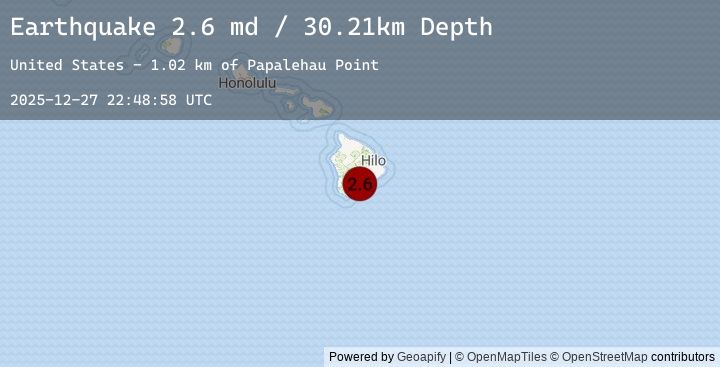
A 2.6 magnitude earthquake struck on 11 km E of Pāhala, Hawaii, at Sat, 27 Dec 2025 22:48:58 GMT. Depth: 30.2099990844727km. Reviewed by USGS seismologists, this minor quake occurred at a magnitude type of md.
Magnitude
2.6
md
Source
USGS
Intensity
-
Earthquake Details
AutomaticEvent IDusgs_hv74861867
Tsunami PotentialNo
Magnitude Typemd
Nearest Places
- Halemaoli1.9 km
- Papalehau Point2.3 km
- Kū‘ē‘ē Ruins2.4 km
- Kamo‘oali‘i Lava Flow2.5 km
- Nali‘ikakani Point2.9 km
Comments
Join the discussion about this event.
Latest Earthquakes
0.7Mag
7 km NW of The Geysers, CA
Time5 minutes ago
Depth3.14 km
SourceUSGS (Automatic)
2.1Mag
PUERTO RICO
Time14 minutes ago
Depth22.10 km
SourceEMSC (Automatic)
1.1Mag
5 km NW of The Geysers, CA
Time21 minutes ago
Depth2.93 km
SourceUSGS (Automatic)
1.8Mag
42 km NW of Toyah, Texas
Time29 minutes ago
Depth4.59 km
SourceUSGS (Automatic)
2.4Mag
107 km NW of Yakutat, Alaska
Time32 minutes ago
Depth2.90 km
SourceUSGS (Automatic)
Nearby Earthquakes
1.9Mag
14 km NE of Pāhala, Hawaii
Time1 hour ago
Depth34.26 km
SourceUSGS (Automatic)
1.9Mag
14 km ESE of Pāhala, Hawaii
Time1 hour ago
Depth27.84 km
SourceUSGS (Automatic)
2.1Mag
12 km S of Fern Forest, Hawaii
Time2 hours ago
Depth3.45 km
SourceUSGS (Automatic)
2.1Mag
ISLAND OF HAWAII, HAWAII
Time2 hours ago
Depth3.50 km
SourceEMSC (Automatic)
2.8Mag
19 km SE of Pāhala, Hawaii
Time7 hours ago
Depth33.20 km
SourceUSGS (Automatic)