Earthquake 10 km S of Pāhala, Hawaii
Thu, 12 Feb 2026 08:53:04 GMT
Time1 week ago
Location
19.1140, -155.4955
Depth
31.1 KM
Event Summary
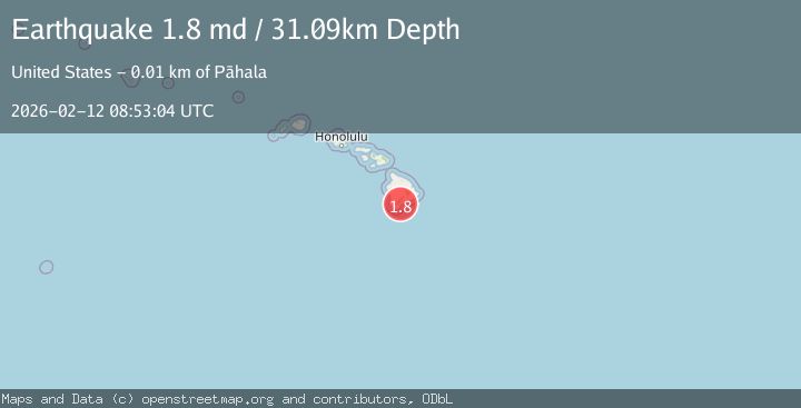
A 1.8 magnitude earthquake struck on 10 km S of Pāhala, Hawaii, at Thu, 12 Feb 2026 08:53:04 GMT. Depth: 31.0900001525879km. Reviewed by USGS seismologists, this minor quake occurred at a magnitude type of md.
Magnitude
1.8
md
Source
USGS
Intensity
-
Agency Reports
1 Sources| Source | Magnitude | Depth | Time |
|---|---|---|---|
| USGSPrimary | 1.8 | 31 km | 1 week ago |
Earthquake Details
AutomaticEvent IDusgs_hv74897972
Tsunami PotentialNo
Magnitude Typemd
Nearest Places
- Kohaahu1.9 km
- Kuhua Bay2.0 km
- Kōloa Beach2.1 km
- Nīnole Cove2.2 km
- Pu‘umoa2.3 km
Comments
Join the discussion about this event.
Latest Earthquakes
2.2Mag
Central Alaska
Time3 minutes ago
Depth0.00 km
SourceVYT (Automatic)
2.2Mag
Tarapaca, Chile
Time4 minutes ago
Depth88.01 km
SourceVYT (Automatic)
2.1Mag
Poland
Time4 minutes ago
Depth0.12 km
SourceVYT (Automatic)
1.1Mag
3 km WSW of Cobb, CA
Time6 minutes ago
Depth1.86 km
SourceUSGS (Automatic)
1.3Mag
Alaska Peninsula
Time7 minutes ago
Depth62.50 km
SourceVYT (Automatic)
Nearby Earthquakes
3.0Mag
ISLAND OF HAWAII, HAWAII
Time5 years ago
Depth50.00 km
SourceNEIC (Automatic)
2.3Mag
ISLAND OF HAWAII, HAWAII
Time1 month ago
Depth35.40 km
SourceHV (Automatic)
2.0Mag
ISLAND OF HAWAII, HAWAII
Time1 month ago
Depth36.00 km
SourceHV (Automatic)
1.7Mag
Hawaii
Time1 month ago
Depth30.13 km
SourceUSGS (Automatic)
2.3Mag
ISLAND OF HAWAII, HAWAII
Time1 month ago
Depth35.10 km
SourceHV (Automatic)