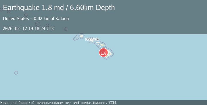
Earthquake 15 km W of Kalaoa, Hawaii
Thu, 12 Feb 2026 19:18:24 GMT
Time6 days ago
Location
19.7220, -156.1288
Depth
6.6 KM
Event Summary
A 1.8 magnitude earthquake struck on 15 km W of Kalaoa, Hawaii, at Thu, 12 Feb 2026 19:18:24 GMT. Depth: 6.59999990463257km. Reviewed by USGS seismologists, this minor quake occurred at a magnitude type of md.
Magnitude
1.8
md
Source
USGS
Intensity
-
Agency Reports
1 Sources| Source | Magnitude | Depth | Time |
|---|---|---|---|
| USGSPrimary | 1.8 | 7 km | 6 days ago |
Earthquake Details
AutomaticEvent IDusgs_hv74898192
Tsunami PotentialNo
Magnitude Typemd
Nearest Places
- Makalawena Bank5.2 km
- Natural Energy Laboratory7.1 km
- Keahole Point7.1 km
- Kalihi Point7.6 km
- Hoona Bay7.6 km
Comments
Join the discussion about this event.
Latest Earthquakes
0.6Mag
12 km SE of Anza, CA
Time4 minutes ago
Depth6.49 km
SourceUSGS (Automatic)
2.6Mag
western Texas
Time6 minutes ago
Depth12.70 km
SourceVYT (Automatic)
2.0Mag
Sumbawa Region, Indonesia
Time7 minutes ago
Depth21.49 km
SourceBMKG
1.0Mag
Southern Alaska
Time7 minutes ago
Depth1.34 km
SourceVYT (Automatic)
1.7Mag
Dead Sea region
Time9 minutes ago
Depth0.00 km
SourceVYT (Automatic)
Nearby Earthquakes
3.0Mag
HAWAII REGION, HAWAII
Time9 years ago
Depth11.00 km
SourceNEIR (Automatic)
3.0Mag
HAWAII REGION, HAWAII
Time8 years ago
Depth34.00 km
SourceNEIR (Automatic)
3.0Mag
HAWAII REGION, HAWAII
Time2 years ago
Depth29.70 km
SourceHV (Automatic)
5.0Mag
HAWAII REGION, HAWAII
Time19 years ago
Depth15.00 km
SourceEMSC (Automatic)
2.1Mag
HAWAII REGION, HAWAII
Time1 week ago
Depth33.90 km
SourceHV (Automatic)