Earthquake 13 km NW of The Geysers, CA
Wed, 07 Jan 2026 01:36:06 GMT
Time3 days ago
Location
38.8402, -122.8767
Depth
2.5 KM
Event Summary
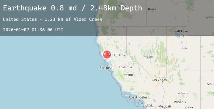
A 0.8 magnitude earthquake struck on 13 km NW of The Geysers, CA, at Wed, 07 Jan 2026 01:36:06 GMT. Depth: 2.48000001907349km. Reviewed by USGS seismologists, this minor quake occurred at a magnitude type of md.
Magnitude
0.8
md
Source
USGS
Intensity
-
Agency Reports
3 Sources| Source | Magnitude | Depth | Time |
|---|---|---|---|
| USGSPrimary | 0.7 | 2 km | 3 days ago |
| USGSPrimary | 0.8 | 1 km | 3 days ago |
| USGSPrimary | 0.8 | 3 km | 2 days ago |
Earthquake Details
AutomaticEvent IDusgs_nc75291806
Tsunami PotentialNo
Magnitude Typemd
Nearest Places
- Alder Creek1.0 km
- Hummingbird Creek1.6 km
- Squaw Creek1.8 km
- Kissack Ranch1.9 km
- Cloverdale Mine Headquarters2.0 km
Comments
Join the discussion about this event.
Latest Earthquakes
2.1Mag
Bali Region, Indonesia
Time2 days ago
Depth42.60 km
SourceBMKG (Automatic)
2.1Mag
WESTERN TURKEY
Time2 days ago
Depth5.80 km
SourceAFAD (Automatic)
2.6Mag
OFFSHORE COQUIMBO, CHILE
Time2 days ago
Depth32.10 km
SourceCSN (Automatic)
5.6Mag
Philippine Islands Region
Time2 days ago
Depth67.67 km
SourceBMKG (Automatic)
2.8Mag
POTOSI, BOLIVIA
Time2 days ago
Depth197.10 km
SourceCSN (Automatic)
Nearby Earthquakes
1.1Mag
7 km WNW of Cobb, CA
Time2 days ago
Depth2.28 km
SourceUSGS (Automatic)
1.1Mag
8 km ESE of Redwood Valley, CA
Time3 days ago
Depth4.90 km
SourceUSGS (Automatic)
2.0Mag
6 km W of Cobb, CA
Time3 days ago
Depth1.24 km
SourceUSGS (Automatic)
0.8Mag
2 km ESE of The Geysers, CA
Time3 days ago
Depth1.06 km
SourceUSGS (Automatic)
0.8Mag
8 km W of Cobb, CA
Time3 days ago
Depth2.10 km
SourceUSGS (Automatic)