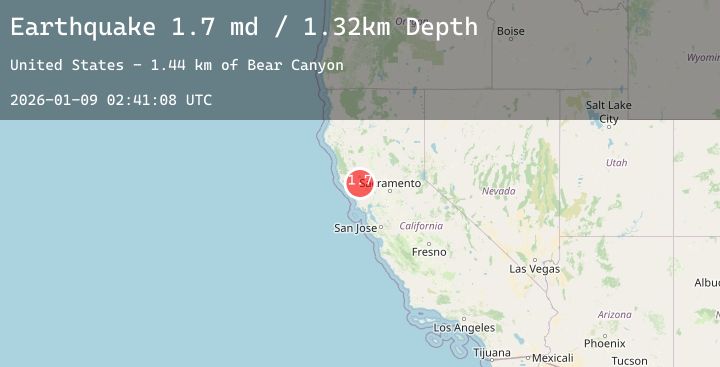
Earthquake 7 km NW of The Geysers, CA
Fri, 09 Jan 2026 02:41:08 GMT
Time22 hours ago
Location
38.8262, -122.8107
Depth
1.3 KM
Event Summary
A 1.7 magnitude earthquake struck on 7 km NW of The Geysers, CA, at Fri, 09 Jan 2026 02:41:08 GMT. Depth: 1.32000005245209km. Reviewed by USGS seismologists, this minor quake occurred at a magnitude type of md.
Magnitude
1.7
md
Source
USGS
Intensity
-
Agency Reports
2 Sources| Source | Magnitude | Depth | Time |
|---|---|---|---|
| USGSPrimary | 1.4 | 1 km | 22 hours ago |
| USGSPrimary | 1.7 | 2 km | 21 hours ago |
Earthquake Details
AutomaticEvent IDusgs_nc75292796
Tsunami PotentialNo
Magnitude Typemd
Nearest Places
- Bear Canyon0.4 km
- Coldwater Canyon1.4 km
- Black Oaks2.0 km
- Caldwell Pines2.2 km
- Caldwell Ranch2.3 km
Comments
Join the discussion about this event.
Latest Earthquakes
0.7Mag
11 km N of Borrego Springs, CA
Time21 hours ago
Depth12.27 km
SourceUSGS (Automatic)
3.2Mag
WESTERN HONSHU, JAPAN
Time21 hours ago
Depth0.00 km
SourceJMA (Automatic)
2.1Mag
15 km WNW of Volcano, Hawaii
Time22 hours ago
Depth12.59 km
SourceUSGS (Automatic)
2.6Mag
Sumba Region, Indonesia
Time22 hours ago
Depth52.89 km
SourceBMKG (Automatic)
3.9Mag
ANTOFAGASTA, CHILE
Time22 hours ago
Depth105.60 km
SourceCSN (Automatic)
Nearby Earthquakes
1.0Mag
8 km WNW of Cobb, CA
Time1 day ago
Depth1.36 km
SourceUSGS (Automatic)
1.3Mag
6 km WNW of Cobb, CA
Time1 day ago
Depth1.07 km
SourceUSGS (Automatic)
0.8Mag
3 km NW of The Geysers, CA
Time1 day ago
Depth1.37 km
SourceUSGS (Automatic)
0.8Mag
9 km WNW of The Geysers, CA
Time1 day ago
Depth1.68 km
SourceUSGS (Automatic)
1.3Mag
4 km NW of The Geysers, CA
Time1 day ago
Depth2.96 km
SourceUSGS (Automatic)