Earthquake 12 km NNW of Angwin, CA
Sat, 10 Jan 2026 11:36:47 GMT
Time2 days ago
Location
38.6787, -122.5042
Depth
6.9 KM
Event Summary
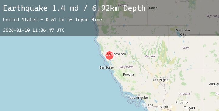
A 1.4 magnitude earthquake struck on 12 km NNW of Angwin, CA, at Sat, 10 Jan 2026 11:36:47 GMT. Depth: 6.92000007629395km. Reviewed by USGS seismologists, this minor quake occurred at a magnitude type of md.
Magnitude
1.4
md
Source
USGS
Intensity
-
Agency Reports
3 Sources| Source | Magnitude | Depth | Time |
|---|---|---|---|
| USGSPrimary | 0.8 | 7 km | 2 days ago |
| USGSPrimary | 0.7 | 2 km | 2 days ago |
| USGSPrimary | 1.4 | 2 km | 2 days ago |
Earthquake Details
AutomaticEvent IDusgs_nc75293526
Tsunami PotentialNo
Magnitude Typemd
Nearest Places
- Toyon Mine0.5 km
- Oat Hill1.1 km
- Ivanhoe Mine1.2 km
- Oat Hill Extension Mine1.3 km
- Aetna Extension Mine1.5 km
Comments
Join the discussion about this event.
Latest Earthquakes
3.1Mag
OFF E. COAST OF N. ISLAND, N.Z.
Time1 day ago
Depth10.10 km
SourceGNS (Automatic)
4.4Mag
PHILIPPINE ISLANDS REGION
Time1 day ago
Depth10.00 km
SourcePIVS (Automatic)
2.3Mag
ISLAND OF HAWAII, HAWAII
Time1 day ago
Depth34.70 km
SourceHV (Automatic)
2.8Mag
POTOSI, BOLIVIA
Time1 day ago
Depth202.00 km
SourceCSN (Automatic)
1.8Mag
SPAIN
Time1 day ago
Depth7.60 km
SourceIGN (Automatic)
Nearby Earthquakes
1.6Mag
8 km SE of Lake Pillsbury, CA
Time1 day ago
Depth7.72 km
SourceUSGS (Automatic)
0.8Mag
3 km NE of The Geysers, CA
Time1 day ago
Depth1.61 km
SourceUSGS (Automatic)
1.0Mag
3 km SW of Anderson Springs, CA
Time2 days ago
Depth1.85 km
SourceUSGS (Automatic)
1.8Mag
6 km NW of The Geysers, CA
Time2 days ago
Depth2.72 km
SourceUSGS (Automatic)
1.0Mag
9 km NW of The Geysers, CA
Time2 days ago
Depth3.50 km
SourceUSGS (Automatic)