Earthquake 6 km NW of The Geysers, CA
Mon, 12 Jan 2026 00:40:12 GMT
Time9 hours ago
Location
38.8213, -122.8038
Depth
2.5 KM
Event Summary
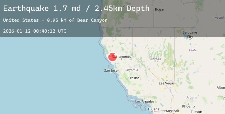
A 1.7 magnitude earthquake struck on 6 km NW of The Geysers, CA, at Mon, 12 Jan 2026 00:40:12 GMT. Depth: 2.45000004768372km. Reviewed by USGS seismologists, this minor quake occurred at a magnitude type of md.
Magnitude
1.7
md
Source
USGS
Intensity
-
Agency Reports
4 Sources| Source | Magnitude | Depth | Time |
|---|---|---|---|
| USGSPrimary | 1.7 | 2 km | 9 hours ago |
| USGSPrimary | 1.1 | 2 km | 9 hours ago |
| USGSPrimary | 1.4 | 2 km | 9 hours ago |
| USGSPrimary | 1.3 | 2 km | 8 hours ago |
Earthquake Details
AutomaticEvent IDusgs_nc75294376
Tsunami PotentialNo
Magnitude Typemd
Nearest Places
- Bear Canyon1.2 km
- Coldwater Canyon2.2 km
- Geyser Canyon2.4 km
- Geysers Resort2.5 km
- Black Oaks2.7 km
Comments
Join the discussion about this event.
Latest Earthquakes
2.1Mag
Sumbawa Region, Indonesia
Time7 hours ago
Depth23.42 km
SourceBMKG (Automatic)
3.1Mag
NORTH ISLAND OF NEW ZEALAND
Time8 hours ago
Depth19.40 km
SourceGNS (Automatic)
2.6Mag
ANTOFAGASTA, CHILE
Time8 hours ago
Depth118.20 km
SourceCSN (Automatic)
1.6Mag
53 km E of McCarthy, Alaska
Time8 hours ago
Depth8.60 km
SourceUSGS (Automatic)
5.6Mag
NORTHWEST OF KURIL ISLANDS
Time8 hours ago
Depth406.50 km
SourceNEIC (Automatic)
Nearby Earthquakes
1.7Mag
13 km WNW of The Geysers, CA
Time10 hours ago
Depth3.27 km
SourceUSGS (Automatic)
1.9Mag
19 km ESE of Boonville, CA
Time12 hours ago
Depth4.57 km
SourceUSGS (Automatic)
1.4Mag
5 km WNW of Cobb, CA
Time13 hours ago
Depth1.78 km
SourceUSGS (Automatic)
1.0Mag
6 km W of Cobb, CA
Time15 hours ago
Depth1.26 km
SourceUSGS (Automatic)
1.1Mag
8 km NW of The Geysers, CA
Time16 hours ago
Depth1.49 km
SourceUSGS (Automatic)