Earthquake 5 km WNW of The Geysers, CA
Thu, 12 Feb 2026 06:09:43 GMT
Time6 days ago
Location
38.7970, -122.8102
Depth
2.9 KM
Event Summary
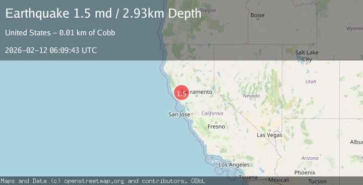
A 1.5 magnitude earthquake struck on 5 km WNW of The Geysers, CA, at Thu, 12 Feb 2026 06:09:43 GMT. Depth: 2.9300000667572km. Reviewed by USGS seismologists, this minor quake occurred at a magnitude type of md.
Magnitude
1.5
md
Source
USGS
Intensity
-
Agency Reports
1 Sources| Source | Magnitude | Depth | Time |
|---|---|---|---|
| USGSPrimary | 1.5 | 3 km | 6 days ago |
Earthquake Details
AutomaticEvent IDusgs_nc75312457
Tsunami PotentialNo
Magnitude Typemd
Nearest Places
- Geysers Resort0.3 km
- Geyser Canyon0.4 km
- Cobb Creek1.5 km
- Buckman Mines Housing Unit Number Two1.7 km
- Buckman Mines Headquarters1.9 km
Comments
Join the discussion about this event.
Latest Earthquakes
1.2Mag
Southern Alaska
Time5 minutes ago
Depth37.11 km
SourceVYT (Automatic)
3.0Mag
Seram, Indonesia
Time5 minutes ago
Depth12.36 km
SourceBMKG
1.1Mag
Washington
Time9 minutes ago
Depth9.64 km
SourceVYT (Automatic)
1.3Mag
WESTERN TURKEY
Time10 minutes ago
Depth8.60 km
SourceAFAD (Automatic)
1.9Mag
32 km NW of Toyah, Texas
Time12 minutes ago
Depth4.09 km
SourceUSGS (Automatic)
Nearby Earthquakes
2.0Mag
5 km WNW of The Geysers, CA
Time6 days ago
Depth3.02 km
SourceUSGS (Automatic)
1.1Mag
5 km WNW of The Geysers, CA
Time2 days ago
Depth3.02 km
SourceUSGS (Automatic)
2.1Mag
5 km WNW of The Geysers, CA
Time1 week ago
Depth3.00 km
SourceUSGS (Automatic)
1.1Mag
6 km WNW of The Geysers, CA
Time1 week ago
Depth3.01 km
SourceUSGS (Automatic)
1.7Mag
6 km WNW of The Geysers, CA
Time4 days ago
Depth3.37 km
SourceUSGS (Automatic)