Earthquake 2 km NE of Almanor, CA
Thu, 12 Feb 2026 18:15:28 GMT
Time1 week ago
Location
40.2308, -121.1558
Depth
3.8 KM
Event Summary
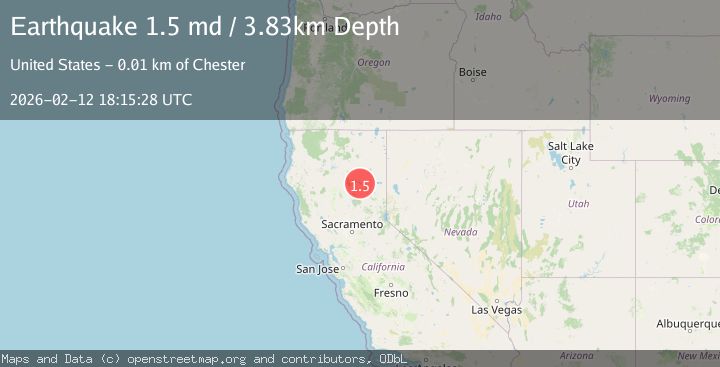
A 1.5 magnitude earthquake struck on 2 km NE of Almanor, CA, at Thu, 12 Feb 2026 18:15:28 GMT. Depth: 3.82999992370605km. Reviewed by USGS seismologists, this minor quake occurred at a magnitude type of md.
Magnitude
1.5
md
Source
USGS
Intensity
-
Agency Reports
1 Sources| Source | Magnitude | Depth | Time |
|---|---|---|---|
| USGSPrimary | 1.5 | 4 km | 1 week ago |
Earthquake Details
AutomaticEvent IDusgs_nc75312792
Tsunami PotentialNo
Magnitude Typemd
Nearest Places
- Lake Almanor0.2 km
- Almanor Peninsula1.1 km
- Lake Almanor Country Club1.8 km
- Bunnel Point1.8 km
- Peninsula Fire Protection District Station 22.1 km
Comments
Join the discussion about this event.
Latest Earthquakes
2.0Mag
northwestern Russia
Time3 minutes ago
Depth0.00 km
SourceVYT (Automatic)
4.7Mag
Molucca Sea
Time5 minutes ago
Depth0.00 km
SourceVYT (Automatic)
1.3Mag
Central Alaska
Time10 minutes ago
Depth10.00 km
SourceVYT (Automatic)
2.2Mag
FRANCE
Time12 minutes ago
Depth5.00 km
SourceReNaSS (Automatic)
2.3Mag
Minahassa Peninsula, Sulawesi
Time12 minutes ago
Depth10.00 km
SourceBMKG
Nearby Earthquakes
2.6Mag
NORTHERN CALIFORNIA
Time1 week ago
Depth1.50 km
SourceNC (Automatic)
2.1Mag
NORTHERN CALIFORNIA
Time1 month ago
Depth5.70 km
SourceNC (Automatic)
2.1Mag
NORTHERN CALIFORNIA
Time1 week ago
Depth3.60 km
SourceNC (Automatic)
3.0Mag
NORTHERN CALIFORNIA
Time11 years ago
Depth5.00 km
SourceNC (Automatic)
3.0Mag
NORTHERN CALIFORNIA
Time2 years ago
Depth6.00 km
SourceNC (Automatic)