Earthquake 24 km NW of Bayview, CA
Tue, 17 Feb 2026 09:35:54 GMT
Time1 day ago
Location
40.8933, -124.4173
Depth
19.0 KM
Event Summary
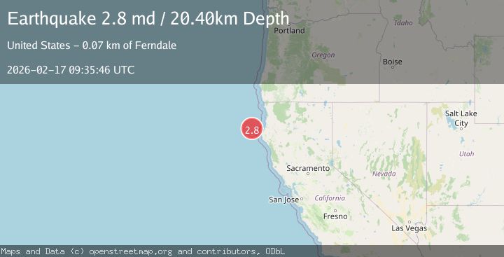
A 2.8 magnitude earthquake struck on 24 km NW of Bayview, CA, at Tue, 17 Feb 2026 09:35:54 GMT. Depth: 18.9799995422363km. Reviewed by USGS seismologists, this minor quake occurred at a magnitude type of md.
Magnitude
2.8
md
Source
USGS
Intensity
-
Agency Reports
2 Sources| Source | Magnitude | Depth | Time |
|---|---|---|---|
| USGSPrimary | 2.8 | 19 km | 1 day ago |
| NEIC | 2.8 | 20 km | 1 day ago |
Earthquake Details
AutomaticEvent IDusgs_nc75315017
Tsunami PotentialNo
Magnitude Typemd
Nearest Places
- Bar Channel20.0 km
- North Jetty20.7 km
- South Jetty20.8 km
- Samoa / Humboldt Bay20.9 km
- Samoa Peninsula21.1 km
Comments
Join the discussion about this event.
Latest Earthquakes
2.8Mag
Sulawesi, Indonesia
Time1 minute ago
Depth21.08 km
SourceBMKG
2.1Mag
WESTERN TURKEY
Time5 minutes ago
Depth12.30 km
SourceKOERI (Automatic)
2.2Mag
Alaska Peninsula
Time6 minutes ago
Depth57.74 km
SourceVYT (Automatic)
3.7Mag
WESTERN TURKEY
Time8 minutes ago
Depth13.30 km
SourceKOERI (Automatic)
1.6Mag
27 km ESE of Balmorhea, Texas
Time9 minutes ago
Depth3.56 km
SourceUSGS (Automatic)
Nearby Earthquakes
3.0Mag
OFFSHORE NORTHERN CALIFORNIA
Time3 years ago
Depth29.00 km
SourceNEIC (Automatic)
6.5Mag
OFFSHORE NORTHERN CALIFORNIA
Time16 years ago
Depth20.00 km
SourceEMSC (Automatic)
3.0Mag
NORTHERN CALIFORNIA
Time8 months ago
Depth23.70 km
SourceNC (Automatic)
2.5Mag
33 km WNW of Ferndale, CA
Time4 days ago
Depth23.54 km
SourceUSGS (Automatic)
5.0Mag
OFFSHORE NORTHERN CALIFORNIA
Time12 years ago
Depth10.00 km
SourceEMSC (Automatic)