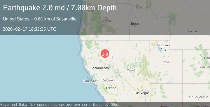
Earthquake 14 km NNW of Susanville, CA
Tue, 17 Feb 2026 18:32:25 GMT
Time16 hours ago
Location
40.5388, -120.6995
Depth
7.0 KM
Event Summary
A 2.0 magnitude earthquake struck on 14 km NNW of Susanville, CA, at Tue, 17 Feb 2026 18:32:25 GMT. Depth: 6.98999977111816km. Reviewed by USGS seismologists, this minor quake occurred at a magnitude type of md.
Magnitude
2.0
md
Source
USGS
Intensity
-
Agency Reports
2 Sources| Source | Magnitude | Depth | Time |
|---|---|---|---|
| USGSPrimary | 2.0 | 7 km | 16 hours ago |
| NC | 2.0 | 7 km | 16 hours ago |
Earthquake Details
AutomaticEvent IDusgs_nc75315297
Tsunami PotentialNo
Magnitude Typemd
Nearest Places
- Romstock Canyon2.2 km
- Deans Meadow2.8 km
- Mahogany Lake2.9 km
- Mahogany Peak3.2 km
- Deans Ridge3.3 km
Comments
Join the discussion about this event.
Latest Earthquakes
2.4Mag
Tarapaca, Chile
Time16 hours ago
Depth115.11 km
SourceVYT (Automatic)
1.6Mag
25 km NE of Mentone, Texas
Time16 hours ago
Depth4.34 km
SourceUSGS (Automatic)
1.6Mag
2 km ESE of The Geysers, CA
Time16 hours ago
Depth3.11 km
SourceUSGS (Automatic)
2.2Mag
AZORES ISLANDS, PORTUGAL
Time16 hours ago
Depth5.00 km
SourcePDA (Automatic)
0.9Mag
7 km WNW of Cobb, CA
Time16 hours ago
Depth1.91 km
SourceUSGS (Automatic)
Nearby Earthquakes
2.7Mag
NORTHERN CALIFORNIA
Time3 weeks ago
Depth5.80 km
SourceNC (Automatic)
2.0Mag
NORTHERN CALIFORNIA
Time1 month ago
Depth6.70 km
SourceNC (Automatic)
2.0Mag
NORTHERN CALIFORNIA
Time1 month ago
Depth5.70 km
SourceNC (Automatic)
2.1Mag
NORTHERN CALIFORNIA
Time1 month ago
Depth3.30 km
SourceNC (Automatic)
2.0Mag
NORTHERN CALIFORNIA
Time1 month ago
Depth5.30 km
SourceNC (Automatic)