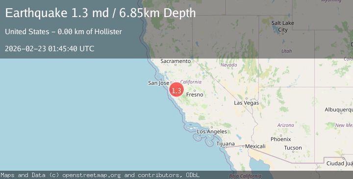
Earthquake 3 km SW of Hollister, CA
Mon, 23 Feb 2026 01:45:40 GMT
Time1 hour ago
Location
36.8285, -121.4208
Depth
6.8 KM
Event Summary
A 1.3 magnitude earthquake struck on 3 km SW of Hollister, CA, at Mon, 23 Feb 2026 01:45:40 GMT. Depth: 6.84999990463257km. Reviewed by USGS seismologists, this minor quake occurred at a magnitude type of md.
Magnitude
1.3
md
Source
USGS
Intensity
-
Agency Reports
1 Sources| Source | Magnitude | Depth | Time |
|---|---|---|---|
| USGSPrimary | 1.3 | 7 km | 1 hour ago |
Earthquake Details
AutomaticEvent IDusgs_nc75317787
Tsunami PotentialNo
Magnitude Typemd
Nearest Places
- 0.9 km
- 1.1 km
- 1.4 km
- 1.7 km
- 1.7 km
Comments
Join the discussion about this event.
Latest Earthquakes
2.1Mag
ISLAND OF HAWAII, HAWAII
Time1 hour ago
Depth10.40 km
SourceHV (Automatic)
2.3Mag
Southeastern Alaska
Time1 hour ago
Depth0.00 km
SourceVYT (Automatic)
3.1Mag
Southern Alaska
Time1 hour ago
Depth61.04 km
SourceVYT (Automatic)
1.6Mag
24 km ENE of Toms Place, CA
Time1 hour ago
Depth7.15 km
SourceUSGS (Automatic)
2.3Mag
Tarapaca, Chile
Time1 hour ago
Depth2.32 km
SourceVYT (Automatic)
Nearby Earthquakes
1.5Mag
2 km SW of Hollister, CA
Time3 weeks ago
Depth8.65 km
SourceUSGS (Automatic)
1.2Mag
2 km SW of Hollister, CA
Time3 weeks ago
Depth7.56 km
SourceUSGS (Automatic)
1.1Mag
3 km W of Ridgemark, CA
Time2 weeks ago
Depth6.84 km
SourceUSGS (Automatic)
2.5Mag
CENTRAL CALIFORNIA
Time1 week ago
Depth7.40 km
SourceNC (Automatic)
3.3Mag
CENTRAL CALIFORNIA
Time1 week ago
Depth7.00 km
SourceNC (Automatic)