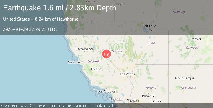
Earthquake 18 km SW of Mina, Nevada
Thu, 29 Jan 2026 22:29:23 GMT
Time3 hours ago
Location
38.2550, -118.2415
Depth
2.8 KM
Event Summary
A 1.6 magnitude earthquake struck on 18 km SW of Mina, Nevada, at Thu, 29 Jan 2026 22:29:23 GMT. Depth: 2.8269km. Reviewed by USGS seismologists, this minor quake occurred at a magnitude type of ml.
Magnitude
1.6
ml
Source
USGS
Intensity
-
Agency Reports
1 Sources| Source | Magnitude | Depth | Time |
|---|---|---|---|
| USGSPrimary | 1.6 | 3 km | 3 hours ago |
Earthquake Details
AutomaticEvent IDusgs_nn00910148
Tsunami PotentialNo
Magnitude Typeml
Nearest Places
- Moho Spring1.3 km
- Federal Mining and Engineering Company Mill1.3 km
- Moho (historical)1.5 km
- Moho Mine1.6 km
- Belleville Springs2.5 km
Comments
Join the discussion about this event.
Latest Earthquakes
2.6Mag
51 km E of Pedro Bay, Alaska
Time10 minutes ago
Depth114.80 km
SourceUSGS (Automatic)
2.7Mag
WESTERN TURKEY
Time13 minutes ago
Depth6.30 km
SourceKOERI (Automatic)
1.9Mag
70 km ENE of Chase, Alaska
Time20 minutes ago
Depth0.90 km
SourceUSGS (Automatic)
1.3Mag
TURKEY-SYRIA-IRAQ BORDER REGION
Time23 minutes ago
Depth9.40 km
SourceAFAD (Automatic)
2.3Mag
WESTERN TURKEY
Time24 minutes ago
Depth11.70 km
SourceKOERI (Automatic)