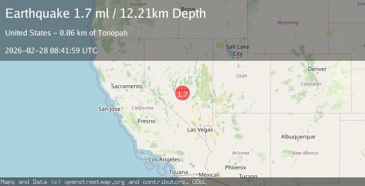
Earthquake 63 km NE of Tonopah, Nevada
Sat, 28 Feb 2026 08:41:59 GMT
Time1 hour ago
Location
38.4100, -116.6504
Depth
12.2 KM
Event Summary
A 1.7 magnitude earthquake struck on 63 km NE of Tonopah, Nevada, at Sat, 28 Feb 2026 08:41:59 GMT. Depth: 12.2101km. Reviewed by USGS seismologists, this minor quake occurred at a magnitude type of ml.
Magnitude
1.7
ml
Source
USGS
Intensity
-
Agency Reports
1 Sources| Source | Magnitude | Depth | Time |
|---|---|---|---|
| USGSPrimary | 1.7 | 12 km | 1 hour ago |
Earthquake Details
AutomaticEvent IDusgs_nn00911336
Tsunami PotentialNo
Magnitude Typeml
Nearest Places
- 1.3 km
- 2.4 km
- 3.3 km
- 3.8 km
- 5.1 km
Comments
Join the discussion about this event.
Latest Earthquakes
3.4Mag
Sumbawa region, Indonesia
Time37 minutes ago
Depth190.31 km
SourceVYT (Automatic)
2.2Mag
Southeastern Alaska
Time43 minutes ago
Depth0.00 km
SourceVYT (Automatic)
1.3Mag
western Texas
Time48 minutes ago
Depth10.00 km
SourceVYT (Automatic)
3.1Mag
THAILAND
Time49 minutes ago
Depth1.00 km
SourceTSB (Automatic)
2.8Mag
Minahassa Peninsula, Sulawesi
Time49 minutes ago
Depth5.00 km
SourceBMKG
Nearby Earthquakes
1.5Mag
53 km NE of Tonopah, Nevada
Time2 hours ago
Depth10.29 km
SourceUSGS (Automatic)
1.8Mag
51 km NE of Tonopah, Nevada
Time2 hours ago
Depth4.41 km
SourceUSGS (Automatic)
1.7Mag
50 km NE of Tonopah, Nevada
Time1 hour ago
Depth3.82 km
SourceUSGS (Automatic)
1.5Mag
63 km ENE of Tonopah, Nevada
Time1 hour ago
Depth8.27 km
SourceUSGS (Automatic)
1.6Mag
78 km NE of Tonopah, Nevada
Time53 minutes ago
Depth13.79 km
SourceUSGS (Automatic)