Earthquake 89 km NE of Tonopah, Nevada
Mon, 02 Mar 2026 00:39:38 GMT
Time1 hour ago
Location
38.5336, -116.4017
Depth
16.0 KM
Event Summary
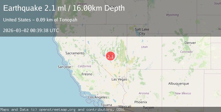
A 2.1 magnitude earthquake struck on 89 km NE of Tonopah, Nevada, at Mon, 02 Mar 2026 00:39:38 GMT. Depth: 15.9825km. Reviewed by USGS seismologists, this minor quake occurred at a magnitude type of ml.
Magnitude
2.1
ml
Source
USGS
Intensity
-
Agency Reports
2 Sources| Source | Magnitude | Depth | Time |
|---|---|---|---|
| USGSPrimary | 2.1 | 16 km | 1 hour ago |
| NN | 2.1 | 16 km | 1 hour ago |
Earthquake Details
AutomaticEvent IDusgs_nn00911568
Tsunami PotentialNo
Magnitude Typeml
Nearest Places
- 0.3 km
- 0.5 km
- 2.2 km
- 2.2 km
- 2.8 km
Comments
Join the discussion about this event.
Latest Earthquakes
2.1Mag
near the coast of Tarapaca, Chile
Time1 hour ago
Depth28.69 km
SourceVYT (Automatic)
1.0Mag
2 km S of Lake Henshaw, CA
Time1 hour ago
Depth8.80 km
SourceUSGS (Automatic)
2.3Mag
northern Sumatra, Indonesia
Time1 hour ago
Depth0.00 km
SourceVYT (Automatic)
2.3Mag
Sumbawa Region, Indonesia
Time1 hour ago
Depth20.94 km
SourceBMKG
2.2Mag
Kenai Peninsula, Alaska
Time1 hour ago
Depth53.96 km
SourceVYT (Automatic)
Nearby Earthquakes
1.6Mag
89 km NE of Tonopah, Nevada
Time1 day ago
Depth6.40 km
SourceUSGS (Automatic)
1.5Mag
87 km NE of Tonopah, Nevada
Time1 day ago
Depth7.36 km
SourceUSGS (Automatic)
1.6Mag
87 km NE of Tonopah, Nevada
Time1 day ago
Depth0.82 km
SourceUSGS (Automatic)
1.6Mag
87 km NE of Tonopah, Nevada
Time1 day ago
Depth0.00 km
SourceUSGS (Automatic)
2.8Mag
NEVADA
Time2 months ago
Depth7.00 km
SourceNEIC (Automatic)