Earthquake 42 km NW of Toyah, Texas
Thu, 15 Jan 2026 20:46:45 GMT
Time3 hours ago
Location
31.5340, -104.1580
Depth
4.5 KM
Event Summary
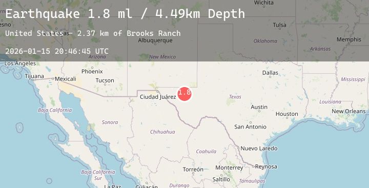
A 1.8 magnitude earthquake struck on 42 km NW of Toyah, Texas, at Thu, 15 Jan 2026 20:46:45 GMT. Depth: 4.4948km. Reviewed by USGS seismologists, this minor quake occurred at a magnitude type of ml.
Magnitude
1.8
ml
Source
USGS
Intensity
-
Agency Reports
2 Sources| Source | Magnitude | Depth | Time |
|---|---|---|---|
| USGSPrimary | 1.8 | 4 km | 3 hours ago |
| USGSPrimary | 1.6 | 6 km | 2 hours ago |
Earthquake Details
AutomaticEvent IDusgs_tx2026bbhmbu
Tsunami PotentialNo
Magnitude Typeml
Nearest Places
- Brooks Ranch1.7 km
- Two Mill Draw2.1 km
- Big Canyon Draw2.5 km
- Gulf Windmill4.3 km
- Little Sulphur Windmill7.3 km
Comments
Join the discussion about this event.
Latest Earthquakes
4.3Mag
TAIWAN
Time15 minutes ago
Depth51.70 km
SourceCWB (Automatic)
5.1Mag
Halmahera, Indonesia
Time17 minutes ago
Depth99.09 km
SourceBMKG (Automatic)
1.5Mag
5 km W of Walker, California
Time29 minutes ago
Depth5.44 km
SourceUSGS
2.2Mag
Near North Coast of West Papua
Time33 minutes ago
Depth12.98 km
SourceBMKG (Automatic)
1.6Mag
6 km W of Cobb, CA
Time39 minutes ago
Depth2.04 km
SourceUSGS (Automatic)
Nearby Earthquakes
2.0Mag
30 km NW of Toyah, Texas
Time1 hour ago
Depth4.75 km
SourceUSGS (Automatic)
2.3Mag
WESTERN TEXAS
Time4 hours ago
Depth4.20 km
SourceTX (Automatic)
1.5Mag
55 km S of Whites City, New Mexico
Time8 hours ago
Depth3.87 km
SourceUSGS (Automatic)
1.9Mag
21 km SSE of Barstow, Texas
Time8 hours ago
Depth6.81 km
SourceUSGS (Automatic)
2.6Mag
57 km S of Whites City, New Mexico
Time13 hours ago
Depth4.66 km
SourceUSGS (Automatic)