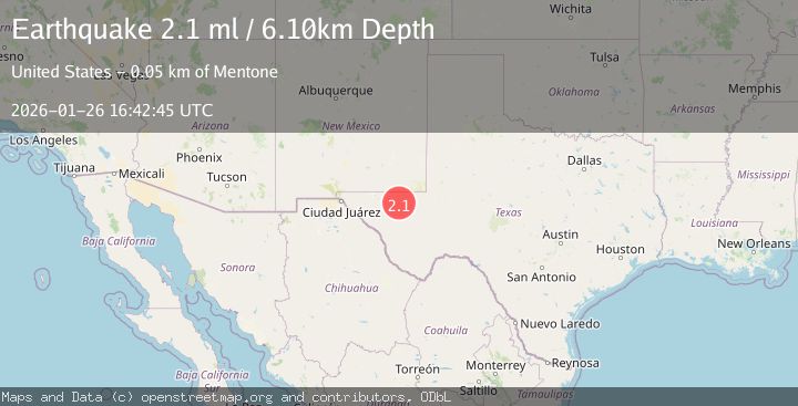
Earthquake 36 km NNW of Toyah, Texas
Mon, 26 Jan 2026 16:04:14 GMT
Time22 hours ago
Location
31.5990, -103.9800
Depth
4.4 KM
Event Summary
A 2.1 magnitude earthquake struck on 36 km NNW of Toyah, Texas, at Mon, 26 Jan 2026 16:04:14 GMT. Depth: 4.4139km. Reviewed by USGS seismologists, this minor quake occurred at a magnitude type of ml.
Magnitude
2.1
ml
Source
USGS
Intensity
-
Agency Reports
2 Sources| Source | Magnitude | Depth | Time |
|---|---|---|---|
| USGSPrimary | 2.1 | 6 km | 21 hours ago |
| TX | 2.1 | 4 km | 21 hours ago |
Earthquake Details
AutomaticEvent IDusgs_tx2026bvdcxa
Tsunami PotentialNo
Magnitude Typeml
Nearest Places
- Cottonwood Tank0.7 km
- Rabbit Tank1.3 km
- Carruthers Tank2.4 km
- Lost Tank4.6 km
- Lynn Tank5.3 km
Comments
Join the discussion about this event.
Latest Earthquakes
2.6Mag
Minahassa Peninsula, Sulawesi
Time17 hours ago
Depth118.00 km
SourceBMKG (Automatic)
2.8Mag
South of Bali, Indonesia
Time17 hours ago
Depth10.00 km
SourceBMKG (Automatic)
1.7Mag
31 km SE of Denali National Park, Alaska
Time17 hours ago
Depth0.60 km
SourceUSGS (Automatic)
2.2Mag
WESTERN TURKEY
Time17 hours ago
Depth14.90 km
SourceKOERI (Automatic)
2.2Mag
13 km NW of Ferry, Alaska
Time17 hours ago
Depth139.50 km
SourceUSGS (Automatic)
Nearby Earthquakes
2.0Mag
WESTERN TEXAS
Time6 days ago
Depth4.30 km
SourceTX (Automatic)
1.5Mag
37 km NW of Toyah, Texas
Time4 days ago
Depth6.63 km
SourceUSGS (Automatic)
1.5Mag
36 km NW of Toyah, Texas
Time2 days ago
Depth5.77 km
SourceUSGS (Automatic)
1.7Mag
34 km NW of Toyah, Texas
Time1 day ago
Depth4.59 km
SourceUSGS (Automatic)
1.8Mag
31 km NW of Toyah, Texas
Time4 days ago
Depth3.43 km
SourceUSGS (Automatic)