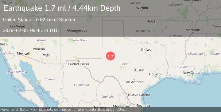
Earthquake 20 km NNW of Stanton, Texas
Sun, 01 Feb 2026 06:46:33 GMT
Time1 week ago
Location
32.3120, -101.8390
Depth
4.4 KM
Event Summary
A 1.7 magnitude earthquake struck on 20 km NNW of Stanton, Texas, at Sun, 01 Feb 2026 06:46:33 GMT. Depth: 4.442km. Reviewed by USGS seismologists, this minor quake occurred at a magnitude type of ml.
Magnitude
1.7
ml
Source
USGS
Intensity
-
Agency Reports
1 Sources| Source | Magnitude | Depth | Time |
|---|---|---|---|
| USGSPrimary | 1.7 | 4 km | 1 week ago |
Earthquake Details
AutomaticEvent IDusgs_tx2026cfkzqh
Tsunami PotentialNo
Magnitude Typeml
Nearest Places
- Lenorah3.6 km
- Lenorah Post Office3.6 km
- Lenorah Volunteer Fire Department4.5 km
- Merrick8.1 km
- Death Valley8.2 km
Comments
Join the discussion about this event.
Latest Earthquakes
2.0Mag
WESTERN TEXAS
Time2 hours ago
Depth8.40 km
SourceTX (Automatic)
2.2Mag
Bali Sea
Time2 hours ago
Depth10.00 km
SourceBMKG (Automatic)
5.9Mag
POTOSI, BOLIVIA
Time2 hours ago
Depth105.00 km
SourceEMSC (Automatic)
1.8Mag
26 km SE of Susitna North, Alaska
Time3 hours ago
Depth23.30 km
SourceUSGS (Automatic)
1.2Mag
23 km N of Borrego Springs, CA
Time3 hours ago
Depth3.28 km
SourceUSGS (Automatic)
Nearby Earthquakes
1.9Mag
19 km N of Stanton, Texas
Time1 week ago
Depth3.58 km
SourceUSGS (Automatic)
1.0Mag
21 km NW of Stanton, Texas
Time2 weeks ago
Depth4.81 km
SourceUSGS (Automatic)
2.5Mag
WESTERN TEXAS
Time1 week ago
Depth3.80 km
SourceTX (Automatic)
2.2Mag
WESTERN TEXAS
Time2 weeks ago
Depth2.70 km
SourceTX (Automatic)
1.6Mag
21 km WNW of Stanton, Texas
Time1 week ago
Depth3.55 km
SourceUSGS (Automatic)