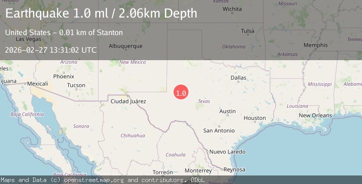
Earthquake 14 km S of Stanton, Texas
Fri, 27 Feb 2026 13:31:02 GMT
Time2 days ago
Location
32.0040, -101.8110
Depth
2.1 KM
Event Summary
A 1.0 magnitude earthquake struck on 14 km S of Stanton, Texas, at Fri, 27 Feb 2026 13:31:02 GMT. Depth: 2.0562km. Reviewed by USGS seismologists, this minor quake occurred at a magnitude type of ml.
Magnitude
1.0
ml
Source
USGS
Intensity
-
Agency Reports
1 Sources| Source | Magnitude | Depth | Time |
|---|---|---|---|
| USGSPrimary | 1.0 | 2 km | 2 days ago |
Earthquake Details
AutomaticEvent IDusgs_tx2026ebrhbk
Tsunami PotentialNo
Magnitude Typeml
Nearest Places
- 3.6 km
- 6.3 km
- 8.3 km
- 8.4 km
- 8.5 km
Comments
Join the discussion about this event.
Latest Earthquakes
1.1Mag
8 km NW of The Geysers, CA
Time6 minutes ago
Depth1.59 km
SourceUSGS (Automatic)
2.3Mag
Southeastern Alaska
Time7 minutes ago
Depth0.00 km
SourceVYT (Automatic)
2.8Mag
Antofagasta, Chile
Time9 minutes ago
Depth119.51 km
SourceVYT (Automatic)
2.0Mag
Sulawesi, Indonesia
Time9 minutes ago
Depth5.39 km
SourceBMKG
2.3Mag
offshore Valparaiso, Chile
Time12 minutes ago
Depth0.00 km
SourceVYT (Automatic)
Nearby Earthquakes
2.2Mag
WESTERN TEXAS
Time1 week ago
Depth0.50 km
SourceTX (Automatic)
1.1Mag
14 km SSE of Stanton, Texas
Time3 weeks ago
Depth3.28 km
SourceUSGS (Automatic)
1.4Mag
21 km S of Stanton, Texas
Time5 days ago
Depth2.60 km
SourceUSGS (Automatic)
1.4Mag
15 km SSE of Stanton, Texas
Time2 hours ago
Depth2.88 km
SourceUSGS (Automatic)
1.5Mag
13 km SSE of Stanton, Texas
Time2 weeks ago
Depth3.10 km
SourceUSGS (Automatic)