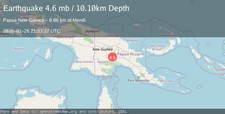
Earthquake 54 km SSW of Mendi, Papua New Guinea
Mon, 26 Jan 2026 21:53:27 GMT
Time2 months ago
Location
-6.6301, 143.5369
Depth
10.1 KM
Event Summary
A 4.6 magnitude earthquake struck on 54 km SSW of Mendi, Papua New Guinea, at Mon, 26 Jan 2026 21:53:27 GMT. Depth: 10.084km. Reviewed by USGS seismologists, this light quake occurred at a magnitude type of mb.
Magnitude
4.6
mb
Source
USGS
Intensity
III
Agency Reports
3 Sources| Source | Magnitude | Depth | Time |
|---|---|---|---|
| USGSPrimary | 4.6 | 10 km | 2 months ago |
| NEIC | 4.6 | 10 km | 2 months ago |
| EMSC | 4.6 | 10 km | 2 months ago |
Earthquake Details
ConfirmedEvent IDusgs_us6000s4l5
QualityS
Tsunami PotentialNo
Magnitude Typemb
Last Update2 months ago
Felt Reports0
Did you feel this earthquake? Report it to help others.
No reports yet
Be the first to report this earthquake!
Latest Earthquakes
Loading...
Nearby Earthquakes
4.5Mag
NEW GUINEA, PAPUA NEW GUINEA
Time3 weeks ago
Depth11.60 km
SourceNEIC (Automatic)
4.2Mag
NEW GUINEA, PAPUA NEW GUINEA
Time2 months ago
Depth10.00 km
SourceNEIC (Automatic)
4.5Mag
NEW GUINEA, PAPUA NEW GUINEA
Time2 months ago
Depth10.00 km
SourceNEIC (Automatic)
5.8Mag
New Guinea, Papua New Guinea
Time2 months ago
Depth122.44 km
SourceBMKG (Automatic)
4.7Mag
NEW GUINEA, PAPUA NEW GUINEA
Time2 months ago
Depth10.00 km
SourceEMSC (Automatic)