Earthquake 152 km SW of Adak, Alaska
Tue, 10 Feb 2026 02:21:51 GMT
Time1 week ago
Location
51.0735, -178.4133
Depth
22.0 KM
Event Summary
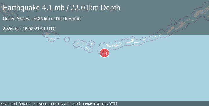
A 4.1 magnitude earthquake struck on 152 km SW of Adak, Alaska, at Tue, 10 Feb 2026 02:21:51 GMT. Depth: 22.012km. Reviewed by USGS seismologists, this light quake occurred at a magnitude type of mb.
Magnitude
4.1
mb
Source
USGS
Intensity
-
Agency Reports
2 Sources| Source | Magnitude | Depth | Time |
|---|---|---|---|
| USGSPrimary | 4.1 | 22 km | 1 week ago |
| AK | 3.4 | 16 km | 1 week ago |
Earthquake Details
ConfirmedEvent IDusgs_us6000s7k1
Tsunami PotentialNo
Magnitude Typemb
Nearest Places
- Kanaga Basin30.4 km
- Kanaga Canyon32.9 km
- Dinkum Point45.6 km
- Uchixsax45.6 km
- Ilak Island45.8 km
Comments
Join the discussion about this event.
Latest Earthquakes
1.2Mag
19 km NNE of Indio, CA
Time2 minutes ago
Depth4.01 km
SourceUSGS (Automatic)
2.5Mag
northwestern Russia
Time5 minutes ago
Depth0.00 km
SourceVYT (Automatic)
1.8Mag
54 km S of Whites City, New Mexico
Time6 minutes ago
Depth6.07 km
SourceUSGS (Automatic)
2.0Mag
Arizona
Time9 minutes ago
Depth8.18 km
SourceVYT (Automatic)
2.9Mag
Bosnia and Herzegovina
Time12 minutes ago
Depth268.68 km
SourceVYT (Automatic)
Nearby Earthquakes
4.4Mag
ANDREANOF ISLANDS, ALEUTIAN IS.
Time1 week ago
Depth22.00 km
SourceNEIC (Automatic)
3.0Mag
ANDREANOF ISLANDS, ALEUTIAN IS.
Time2 years ago
Depth22.90 km
SourceAK (Automatic)
3.2Mag
ANDREANOF ISLANDS, ALEUTIAN IS.
Time1 month ago
Depth15.90 km
SourceAK (Automatic)
4.9Mag
ANDREANOF ISLANDS, ALEUTIAN IS.
Time0 months ago
Depth24.90 km
SourceEMSC (Automatic)
3.0Mag
ANDREANOF ISLANDS, ALEUTIAN IS.
Time2 years ago
Depth22.20 km
SourceAK (Automatic)