Earthquake 275 km E of Levuka, Fiji
Thu, 12 Feb 2026 13:52:05 GMT
Time1 week ago
Location
-18.2110, -178.0852
Depth
554.9 KM
Event Summary
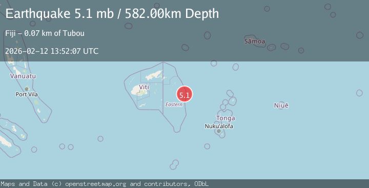
A 5.1 magnitude earthquake struck on 275 km E of Levuka, Fiji, at Thu, 12 Feb 2026 13:52:05 GMT. Depth: 554.907km. Reviewed by USGS seismologists, this moderate quake occurred at a magnitude type of mb.
Magnitude
5.1
mb
Source
USGS
Intensity
-
Agency Reports
3 Sources| Source | Magnitude | Depth | Time |
|---|---|---|---|
| USGSPrimary | 5.1 | 555 km | 1 week ago |
| NEIC | 5.1 | 555 km | 1 week ago |
| EMSC | 5.1 | 582 km | 1 week ago |
Earthquake Details
ConfirmedEvent IDusgs_us6000s8h7
Tsunami PotentialNo
Magnitude Typemb
Nearest Places
- 24.9 km
- 32.2 km
- 34.7 km
- 37.9 km
- 38.4 km
Comments
Join the discussion about this event.
Latest Earthquakes
2.5Mag
Hungary
Time1 minute ago
Depth0.00 km
SourceVYT (Automatic)
1.7Mag
Fox Islands, Aleutian Islands, Alaska
Time3 minutes ago
Depth74.46 km
SourceVYT (Automatic)
1.6Mag
British Columbia, Canada
Time4 minutes ago
Depth13.43 km
SourceVYT (Automatic)
2.1Mag
Tarapaca, Chile
Time8 minutes ago
Depth85.21 km
SourceVYT (Automatic)
3.2Mag
San Juan, Argentina
Time13 minutes ago
Depth144.04 km
SourceVYT (Automatic)
Nearby Earthquakes
5.7Mag
FIJI REGION
Time10 years ago
Depth491.00 km
SourceEMSC (Automatic)
5.0Mag
FIJI REGION
Time3 years ago
Depth539.00 km
SourceEMSC (Automatic)
5.0Mag
FIJI REGION
Time19 years ago
Depth500.00 km
SourceEMSC (Automatic)
5.1Mag
FIJI REGION
Time10 years ago
Depth563.00 km
SourceEMSC (Automatic)
4.0Mag
FIJI REGION
Time1 year ago
Depth579.30 km
SourceNEIC (Automatic)