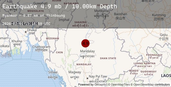
Earthquake 32 km NE of Shwebo, Burma (Myanmar)
Thu, 01 Jan 2026 13:18:59 GMT
Time3 hours ago
Location
22.7786, 95.9225
Depth
10.0 KM
Event Summary
A 4.9 magnitude earthquake struck on 32 km NE of Shwebo, Burma (Myanmar), at Thu, 01 Jan 2026 13:18:59 GMT. Depth: 10km. Reviewed by USGS seismologists, this light quake occurred at a magnitude type of mb.
Magnitude
4.9
mb
Source
USGS
Intensity
-
Earthquake Details
ConfirmedEvent IDusgs_us7000rlx8
Tsunami PotentialNo
Magnitude Typemb
Nearest Places
- Thinbaung0.9 km
- Kokko-aing2.4 km
- Ngapyawdaw Chaung2.6 km
- Kokko-aing Chaung2.7 km
- Nat Taung3.0 km
Comments
Join the discussion about this event.
Latest Earthquakes
2.5Mag
Seram, Indonesia
Time2 hours ago
Depth13.45 km
SourceBMKG (Automatic)
4.4Mag
BIO-BIO, CHILE
Time3 hours ago
Depth54.20 km
SourceEMSC (Automatic)
1.5Mag
58 km N of Karluk, Alaska
Time3 hours ago
Depth5.00 km
SourceUSGS (Automatic)
2.8Mag
TARAPACA, CHILE
Time3 hours ago
Depth109.90 km
SourceEMSC (Automatic)
1.1Mag
WESTERN TURKEY
Time3 hours ago
Depth10.50 km
SourceEMSC (Automatic)
Nearby Earthquakes
No significant earthquakes nearby recently.