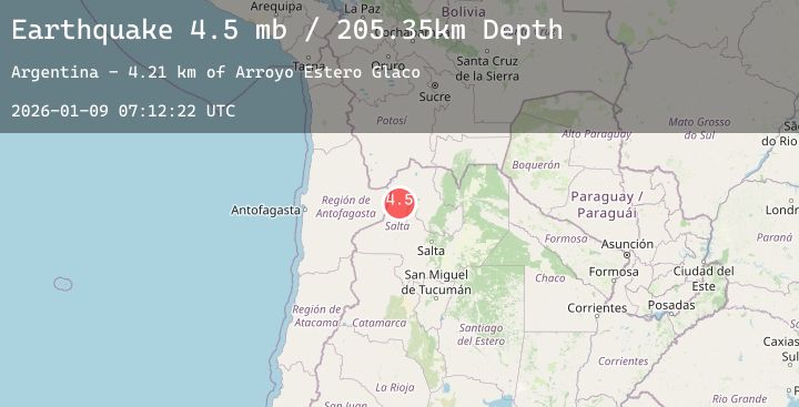
Earthquake 95 km NNW of San Antonio de los Cobres, Argentina
Fri, 09 Jan 2026 07:12:22 GMT
Time2 days ago
Location
-23.4151, -66.6729
Depth
205.4 KM
Event Summary
A 4.5 magnitude earthquake struck on 95 km NNW of San Antonio de los Cobres, Argentina, at Fri, 09 Jan 2026 07:12:22 GMT. Depth: 205.354km. Reviewed by USGS seismologists, this light quake occurred at a magnitude type of mb.
Magnitude
4.5
mb
Source
USGS
Intensity
-
Agency Reports
2 Sources| Source | Magnitude | Depth | Time |
|---|---|---|---|
| USGSPrimary | 4.5 | 205 km | 2 days ago |
| NEIC | 4.5 | 205 km | 2 days ago |
Earthquake Details
ConfirmedEvent IDusgs_us7000rnlu
Tsunami PotentialNo
Magnitude Typemb
Nearest Places
- Río Rosario5.0 km
- Salina Olaroz6.0 km
- Bávaros9.1 km
- Departamento de Susques9.5 km
- Arroyo Olaroz Grande9.5 km
Comments
Join the discussion about this event.
Latest Earthquakes
2.3Mag
Sulawesi, Indonesia
Time2 days ago
Depth10.00 km
SourceBMKG (Automatic)
1.8Mag
71 km ESE of Denali Park, Alaska
Time2 days ago
Depth5.00 km
SourceUSGS (Automatic)
3.3Mag
GUATEMALA
Time2 days ago
Depth3.00 km
SourceINET (Automatic)
2.1Mag
67 km SW of Skwentna, Alaska
Time2 days ago
Depth125.10 km
SourceUSGS (Automatic)
3.0Mag
Northern Sumatra, Indonesia
Time2 days ago
Depth4.11 km
SourceBMKG (Automatic)
Nearby Earthquakes
No significant earthquakes nearby recently.