Earthquake 82 km SW of Teluk Dalam, Indonesia
Tue, 20 Jan 2026 16:25:23 GMT
Time6 days ago
Location
0.0814, 97.2468
Depth
10.0 KM
Event Summary
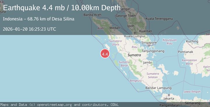
A 4.4 magnitude earthquake struck on 82 km SW of Teluk Dalam, Indonesia, at Tue, 20 Jan 2026 16:25:23 GMT. Depth: 10km. Reviewed by USGS seismologists, this light quake occurred at a magnitude type of mb.
Magnitude
4.4
mb
Source
USGS
Intensity
-
Agency Reports
1 Sources| Source | Magnitude | Depth | Time |
|---|---|---|---|
| USGSPrimary | 4.4 | 10 km | 6 days ago |
Earthquake Details
ConfirmedEvent IDusgs_us7000rqv2
Tsunami PotentialNo
Magnitude Typemb
Nearest Places
- Desa Silina68.7 km
- Desa Gobo Baru69.4 km
- Desa Silina Baru70.6 km
- Pulau Simuk71.0 km
- Desa Gobo71.8 km
Comments
Join the discussion about this event.
Latest Earthquakes
1.2Mag
13 km WSW of Stanton, Texas
Time16 hours ago
Depth3.46 km
SourceUSGS (Automatic)
2.0Mag
WESTERN TURKEY
Time16 hours ago
Depth7.60 km
SourceKOERI (Automatic)
4.4Mag
Sulawesi, Indonesia
Time16 hours ago
Depth5.00 km
SourceBMKG (Automatic)
1.1Mag
11 km N of Quilcene, Washington
Time17 hours ago
Depth20.76 km
SourceUSGS
1.8Mag
PYRENEES
Time17 hours ago
Depth1.40 km
SourceIGN (Automatic)
Nearby Earthquakes
2.4Mag
Northern Sumatra, Indonesia
Time2 days ago
Depth10.00 km
SourceBMKG (Automatic)
2.6Mag
Northern Sumatra, Indonesia
Time4 days ago
Depth3.77 km
SourceBMKG (Automatic)
2.7Mag
Southern Sumatra, Indonesia
Time1 day ago
Depth22.17 km
SourceBMKG (Automatic)
3.6Mag
Southwest of Sumatra, Indonesia
Time3 days ago
Depth77.60 km
SourceBMKG (Automatic)
2.7Mag
NORTHERN SUMATRA, INDONESIA
Time1 day ago
Depth130.00 km
SourceBMKG (Automatic)