Earthquake Southern Sumatra, Indonesia
Sun, 25 Jan 2026 22:28:36 GMT
Time1 day ago
Location
-0.4545, 98.9063
Depth
22.2 KM
Event Summary
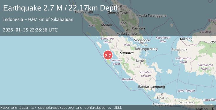
A 2.7 magnitude earthquake struck on Southern Sumatra, Indonesia, at Sun, 25 Jan 2026 22:28:36 GMT. Depth: 22.170954km. Reviewed by BMKG seismologists, this minor quake occurred at a magnitude type of M.
Magnitude
2.7
M
Source
BMKG
Intensity
-
Agency Reports
1 Sources| Source | Magnitude | Depth | Time |
|---|---|---|---|
| BMKGPrimary | 2.7 | 22 km | 1 day ago |
Earthquake Details
AutomaticEvent IDbmg2026btoo
Tsunami PotentialNo
Magnitude TypeM
Nearest Places
- Karang Drakes39.2 km
- Desa Bawo Analita Saeru40.0 km
- Pulau Karanganjing40.1 km
- Tanjung Saire42.2 km
- Tanjung Anjing42.5 km
Comments
Join the discussion about this event.
Latest Earthquakes
2.0Mag
Sumbawa Region, Indonesia
Time1 hour ago
Depth107.77 km
SourceBMKG (Automatic)
1.7Mag
26 km WNW of Ludlow, CA
Time1 hour ago
Depth1.36 km
SourceUSGS (Automatic)
3.1Mag
HAITI REGION
Time1 hour ago
Depth7.00 km
SourceAYIT (Automatic)
2.6Mag
PUERTO RICO
Time1 hour ago
Depth16.10 km
SourcePR (Automatic)
2.1Mag
WESTERN TEXAS
Time1 hour ago
Depth4.40 km
SourceTX (Automatic)
Nearby Earthquakes
4.1Mag
KEP. MENTAWAI REGION, INDONESIA
Time6 days ago
Depth48.00 km
SourceBMKG (Automatic)
2.9Mag
Northern Sumatra, Indonesia
Time11 hours ago
Depth7.87 km
SourceBMKG (Automatic)
2.5Mag
NORTHERN SUMATRA, INDONESIA
Time3 days ago
Depth8.00 km
SourceBMKG (Automatic)
2.7Mag
NORTHERN SUMATRA, INDONESIA
Time1 day ago
Depth130.00 km
SourceBMKG (Automatic)
2.9Mag
Northern Sumatra, Indonesia
Time4 days ago
Depth147.68 km
SourceBMKG (Automatic)