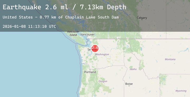
Earthquake 7 km ESE of Lake Roesiger, Washington
Thu, 08 Jan 2026 11:13:10 GMT
Time2 days ago
Location
47.9480, -121.8403
Depth
7.1 KM
Event Summary
A 2.6 magnitude earthquake struck on 7 km ESE of Lake Roesiger, Washington, at Thu, 08 Jan 2026 11:13:10 GMT. Depth: 7.13000011444092km. Reviewed by USGS seismologists, this minor quake occurred at a magnitude type of ml.
Magnitude
2.6
ml
Source
USGS
Intensity
-
Agency Reports
1 Sources| Source | Magnitude | Depth | Time |
|---|---|---|---|
| USGSPrimary | 2.6 | 7 km | 2 days ago |
Earthquake Details
AutomaticEvent IDusgs_uw62222156
Tsunami PotentialNo
Magnitude Typeml
Nearest Places
- Chaplain Lake South Dam0.8 km
- Everett Water Work Intake1.0 km
- Lost Lake1.1 km
- Lake Chaplain1.3 km
- Woods Lake2.3 km
Comments
Join the discussion about this event.
Latest Earthquakes
2.4Mag
FRANCE
Time2 days ago
Depth15.90 km
SourceReNaSS (Automatic)
2.6Mag
West Papua Region, Indonesia
Time2 days ago
Depth10.00 km
SourceBMKG (Automatic)
2.9Mag
ALBANIA
Time2 days ago
Depth15.00 km
SourceIGEO (Automatic)
1.8Mag
19 km ESE of Skwentna, Alaska
Time2 days ago
Depth10.50 km
SourceUSGS (Automatic)
2.4Mag
Northern Sumatra, Indonesia
Time2 days ago
Depth10.35 km
SourceBMKG (Automatic)
Nearby Earthquakes
No significant earthquakes nearby recently.