Earthquake northern Sumatra, Indonesia
Sun, 15 Feb 2026 08:27:03 GMT
Time2 days ago
Location
4.7791, 96.1860
Depth
0.0 KM
Event Summary
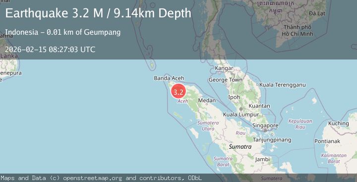
A 3.2 magnitude earthquake struck on northern Sumatra, Indonesia, at Sun, 15 Feb 2026 08:27:03 GMT. Depth: 0km. Reviewed by VYT seismologists, this minor quake occurred at a magnitude type of earthquake.
Magnitude
3.2
earthquake
Source
VYT
Intensity
-
Agency Reports
2 Sources| Source | Magnitude | Depth | Time |
|---|---|---|---|
| VYTPrimary | 3.2 | 0 km | 2 days ago |
| BMKG | 3.2 | 9 km | 2 days ago |
Earthquake Details
AutomaticEvent IDvyt_104ciyuzx2k77
Tsunami PotentialNo
Magnitude Typeearthquake
Nearest Places
- Alue Tiga0.8 km
- Seureungohkualaalue-raja0.8 km
- Alue Kala1.0 km
- Alue Lhakkaluet1.1 km
- Alue Raya1.4 km
Comments
Join the discussion about this event.
Latest Earthquakes
2.0Mag
Central California
Time6 hours ago
Depth0.00 km
SourceVYT (Automatic)
0.7Mag
4 km NW of The Geysers, CA
Time6 hours ago
Depth3.05 km
SourceUSGS (Automatic)
2.7Mag
northern Colombia
Time6 hours ago
Depth73.00 km
SourceVYT (Automatic)
1.0Mag
4 km W of Lake Henshaw, CA
Time6 hours ago
Depth12.06 km
SourceUSGS (Automatic)
1.4Mag
4 km W of Lake Henshaw, CA
Time6 hours ago
Depth12.37 km
SourceUSGS (Automatic)
Nearby Earthquakes
3.0Mag
NORTHERN SUMATRA, INDONESIA
Time8 months ago
Depth10.00 km
SourceBMKG (Automatic)
2.7Mag
NORTHERN SUMATRA, INDONESIA
Time1 month ago
Depth13.00 km
SourceBMKG (Automatic)
5.3Mag
NORTHERN SUMATRA, INDONESIA
Time8 years ago
Depth13.00 km
SourceEMSC (Automatic)
2.1Mag
Northern Sumatra, Indonesia
Time3 weeks ago
Depth8.15 km
SourceBMKG (Automatic)
3.0Mag
NORTHERN SUMATRA, INDONESIA
Time4 years ago
Depth13.00 km
SourceDJA (Automatic)