Earthquake Northern Territory, Australia
Fri, 27 Feb 2026 12:39:02 GMT
Time1 hour ago
Location
-20.1507, 133.6010
Depth
289.9 KM
Event Summary
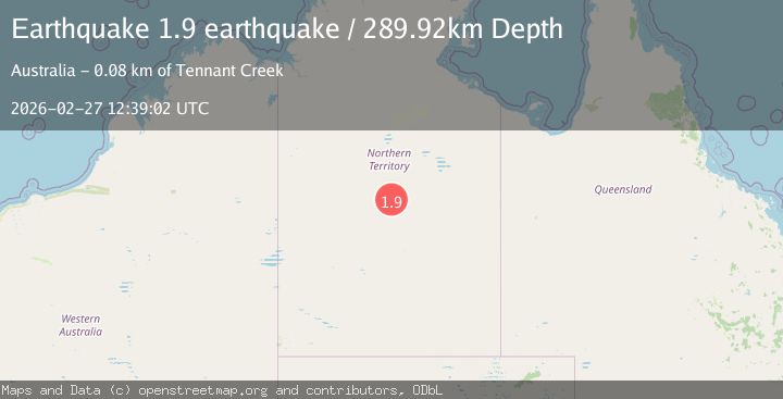
A 1.9 magnitude earthquake struck on Northern Territory, Australia, at Fri, 27 Feb 2026 12:39:02 GMT. Depth: 289.9169921875km. Reviewed by VYT seismologists, this minor quake occurred at a magnitude type of earthquake.
Magnitude
1.9
earthquake
Source
VYT
Intensity
-
Agency Reports
1 Sources| Source | Magnitude | Depth | Time |
|---|---|---|---|
| VYTPrimary | 1.9 | 290 km | 1 hour ago |
Earthquake Details
AutomaticEvent IDvyt_10s0jsm8g7ufm
Tsunami PotentialNo
Magnitude Typeearthquake
Nearest Places
- 25.3 km
- 26.8 km
- 29.0 km
- 30.6 km
- 32.3 km
Comments
Join the discussion about this event.
Latest Earthquakes
2.7Mag
Central Alaska
Time1 hour ago
Depth30.15 km
SourceVYT (Automatic)
2.1Mag
Central Alaska
Time1 hour ago
Depth115.97 km
SourceVYT (Automatic)
3.6Mag
southern Peru
Time1 hour ago
Depth208.86 km
SourceVYT (Automatic)
2.9Mag
Azerbaijan
Time1 hour ago
Depth0.00 km
SourceVYT (Automatic)
1.2Mag
3 km ESE of Loma Linda, CA
Time1 hour ago
Depth3.39 km
SourceUSGS (Automatic)
Nearby Earthquakes
0.8Mag
Northern Territory, Australia
Time1 week ago
Depth15.26 km
SourceVYT (Automatic)
5.4Mag
NORTHERN TERRITORY, AUSTRALIA
Time6 years ago
Depth10.00 km
SourceEMSC (Automatic)
3.0Mag
NORTHERN TERRITORY, AUSTRALIA
Time3 years ago
Depth10.00 km
SourceAUST (Automatic)
2.7Mag
NORTHERN TERRITORY, AUSTRALIA
Time1 month ago
Depth10.00 km
SourceAUST (Automatic)
3.0Mag
NORTHERN TERRITORY, AUSTRALIA
Time4 years ago
Depth2.00 km
SourceAUST (Automatic)