Earthquake Southern Alaska
Fri, 13 Feb 2026 01:46:15 GMT
Time5 days ago
Location
61.3369, -152.2397
Depth
2.8 KM
Event Summary
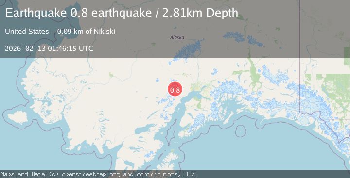
A 0.8 magnitude earthquake struck on Southern Alaska, at Fri, 13 Feb 2026 01:46:15 GMT. Depth: 2.8076171875km. Reviewed by VYT seismologists, this minor quake occurred at a magnitude type of earthquake.
Magnitude
0.8
earthquake
Source
VYT
Intensity
-
Agency Reports
1 Sources| Source | Magnitude | Depth | Time |
|---|---|---|---|
| VYTPrimary | 0.8 | 3 km | 5 days ago |
Earthquake Details
AutomaticEvent IDvyt_113f4pfudgmvr
Tsunami PotentialNo
Magnitude Typeearthquake
Nearest Places
- Mount Chichantna1.9 km
- Spurr Ice Plateau1.9 km
- The Rowel3.5 km
- Mount Spurr4.2 km
- Barrier Glacier6.8 km
Comments
Join the discussion about this event.
Latest Earthquakes
1.0Mag
4 km W of Lake Henshaw, CA
Time9 hours ago
Depth12.06 km
SourceUSGS (Automatic)
1.4Mag
4 km W of Lake Henshaw, CA
Time9 hours ago
Depth12.37 km
SourceUSGS (Automatic)
1.6Mag
41 km NW of Toyah, Texas
Time9 hours ago
Depth3.46 km
SourceUSGS (Automatic)
0.7Mag
6 km WNW of Cobb, CA
Time9 hours ago
Depth-0.59 km
SourceUSGS (Automatic)
1.0Mag
Southern Alaska
Time9 hours ago
Depth0.12 km
SourceVYT (Automatic)
Nearby Earthquakes
0.6Mag
Southern Alaska
Time4 days ago
Depth0.00 km
SourceVYT (Automatic)
0.7Mag
Southern Alaska
Time4 days ago
Depth0.00 km
SourceVYT (Automatic)
0.6Mag
Southern Alaska
Time4 days ago
Depth3.42 km
SourceVYT (Automatic)
0.6Mag
Southern Alaska
Time3 days ago
Depth15.14 km
SourceVYT (Automatic)
0.9Mag
66 km WNW of Beluga, Alaska
Time6 days ago
Depth12.90 km
SourceUSGS (Automatic)