Earthquake Kepulauan Talaud, Indonesia
Fri, 20 Feb 2026 10:22:17 GMT
Time1 hour ago
Location
4.9781, 126.2140
Depth
85.6 KM
Event Summary
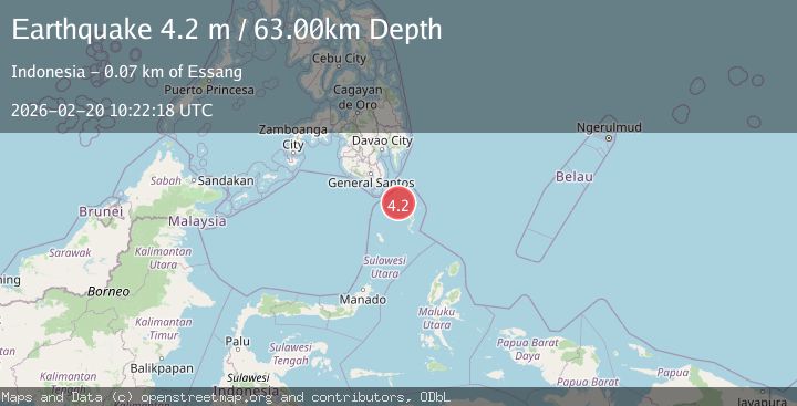
A 4.2 magnitude earthquake struck on Kepulauan Talaud, Indonesia, at Fri, 20 Feb 2026 10:22:17 GMT. Depth: 85.5712890625km. Reviewed by VYT seismologists, this light quake occurred at a magnitude type of earthquake.
Magnitude
4.2
earthquake
Source
VYT
Intensity
-
Agency Reports
1 Sources| Source | Magnitude | Depth | Time |
|---|---|---|---|
| VYTPrimary | 4.2 | 86 km | 1 hour ago |
Earthquake Details
AutomaticEvent IDvyt_14q9uapp1fbcb
Tsunami PotentialNo
Magnitude Typeearthquake
Nearest Places
- Sangihe Trough16.6 km
- Pulau Baronto74.9 km
- Miangas75.5 km
- Tanjung Ambora75.7 km
- Saan75.9 km
Comments
Join the discussion about this event.
Latest Earthquakes
2.0Mag
Antofagasta, Chile
Time1 hour ago
Depth127.32 km
SourceVYT (Automatic)
2.0Mag
Southern California
Time1 hour ago
Depth14.40 km
SourceVYT (Automatic)
3.0Mag
Potosi, Bolivia
Time1 hour ago
Depth188.11 km
SourceVYT (Automatic)
1.3Mag
9 km WNW of The Geysers, CA
Time1 hour ago
Depth2.36 km
SourceUSGS (Automatic)
1.7Mag
British Columbia, Canada
Time1 hour ago
Depth15.99 km
SourceVYT (Automatic)
Nearby Earthquakes
3.0Mag
KEPULAUAN TALAUD, INDONESIA
Time1 year ago
Depth15.00 km
SourcePIVS (Automatic)
3.0Mag
MINDANAO, PHILIPPINES
Time2 years ago
Depth1.00 km
SourcePIVS (Automatic)
3.0Mag
KEPULAUAN TALAUD, INDONESIA
Time3 years ago
Depth26.00 km
SourcePIVS (Automatic)
3.0Mag
MINDANAO, PHILIPPINES
Time4 years ago
Depth11.00 km
SourcePIVS (Automatic)
3.0Mag
KEPULAUAN TALAUD, INDONESIA
Time1 year ago
Depth3.00 km
SourcePIVS (Automatic)