Earthquake southern Sumatra, Indonesia
Thu, 05 Mar 2026 22:06:08 GMT
Time1 hour ago
Location
-4.5786, 102.7672
Depth
57.3 KM
Event Summary
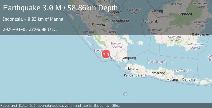
A 3.4 magnitude earthquake struck on southern Sumatra, Indonesia, at Thu, 05 Mar 2026 22:06:08 GMT. Depth: 57.2509765625km. Reviewed by VYT seismologists, this minor quake occurred at a magnitude type of M.
Magnitude
3.4
M
Source
VYT
Intensity
-
Agency Reports
2 Sources| Source | Magnitude | Depth | Time |
|---|---|---|---|
| VYTPrimary | 3.4 | 57 km | 1 hour ago |
| BMKG | 2.9 | 29 km | 1 hour ago |
Earthquake Details
AutomaticEvent IDvyt_1bbz8fj2boyj7
Tsunami PotentialNo
Magnitude TypeM
Nearest Places
- 17.8 km
- 18.1 km
- 18.8 km
- 18.8 km
- 19.0 km
Comments
Join the discussion about this event.
Latest Earthquakes
3.4Mag
OFF COAST OF COSTA RICA
Time1 hour ago
Depth5.00 km
SourceINET (Automatic)
3.5Mag
Papua region, Indonesia
Time1 hour ago
Depth475.22 km
SourceVYT (Automatic)
4.0Mag
North Pacific Ocean
Time1 hour ago
Depth19.29 km
SourceVYT (Automatic)
0.9Mag
3 km S of Cobb, CA
Time1 hour ago
Depth1.78 km
SourceUSGS (Automatic)
1.6Mag
Southern Alaska
Time1 hour ago
Depth71.53 km
SourceVYT (Automatic)
Nearby Earthquakes
5.2Mag
SOUTHERN SUMATRA, INDONESIA
Time13 years ago
Depth80.00 km
SourceEMSC (Automatic)
2.9Mag
SOUTHERN SUMATRA, INDONESIA
Time1 month ago
Depth45.00 km
SourceBMKG (Automatic)
3.0Mag
SOUTHERN SUMATRA, INDONESIA
Time3 years ago
Depth37.00 km
SourceDJA (Automatic)
3.0Mag
SOUTHERN SUMATRA, INDONESIA
Time8 months ago
Depth34.00 km
SourceBMKG (Automatic)
5.3Mag
SOUTHERN SUMATRA, INDONESIA
Time7 years ago
Depth68.00 km
SourceEMSC (Automatic)