Earthquake near the south coast of Papua, Indonesia
Sun, 15 Feb 2026 12:47:39 GMT
Time4 days ago
Location
-8.6566, 137.2373
Depth
383.3 KM
Event Summary
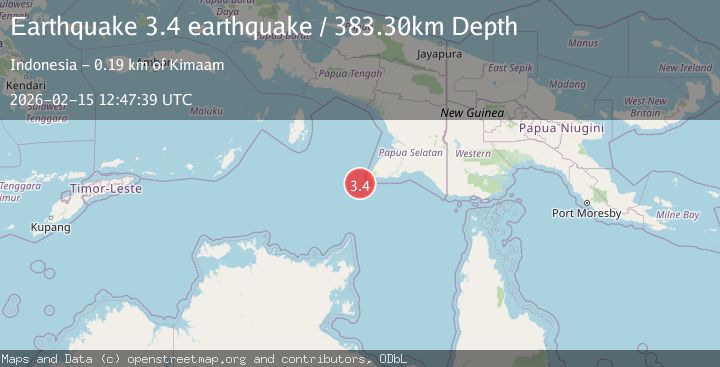
A 3.4 magnitude earthquake struck on near the south coast of Papua, Indonesia, at Sun, 15 Feb 2026 12:47:39 GMT. Depth: 383.30078125km. Reviewed by VYT seismologists, this minor quake occurred at a magnitude type of earthquake.
Magnitude
3.4
earthquake
Source
VYT
Intensity
-
Agency Reports
1 Sources| Source | Magnitude | Depth | Time |
|---|---|---|---|
| VYTPrimary | 3.4 | 383 km | 4 days ago |
Earthquake Details
AutomaticEvent IDvyt_1myqthiawnmb8
Tsunami PotentialNo
Magnitude Typeearthquake
Nearest Places
- Tanjung Vals51.3 km
- Kampung Kladar56.1 km
- Kladar59.6 km
- Sabon61.3 km
- Kampung Sabon67.5 km
Comments
Join the discussion about this event.
Latest Earthquakes
3.3Mag
West Papua, Indonesia
Time5 minutes ago
Depth10.00 km
SourceBMKG
2.4Mag
Sumbawa Region, Indonesia
Time6 minutes ago
Depth24.94 km
SourceBMKG
2.2Mag
Tarapaca, Chile
Time14 minutes ago
Depth53.71 km
SourceVYT (Automatic)
3.9Mag
Mindanao, Philippines
Time15 minutes ago
Depth10.00 km
SourceBMKG
1.2Mag
WESTERN TURKEY
Time15 minutes ago
Depth7.00 km
SourceAFAD (Automatic)
Nearby Earthquakes
3.0Mag
near the south coast of Papua, Indonesia
Time1 week ago
Depth562.62 km
SourceVYT (Automatic)
4.7Mag
ARAFURA SEA
Time1 month ago
Depth10.00 km
SourceEMSC (Automatic)
5.0Mag
ARAFURA SEA
Time4 years ago
Depth10.00 km
SourceEMSC (Automatic)
3.5Mag
off the south coast of Papua, Indonesia
Time4 days ago
Depth167.48 km
SourceVYT (Automatic)
5.5Mag
NEAR S COAST OF PAPUA, INDONESIA
Time10 months ago
Depth35.00 km
SourceEMSC (Automatic)