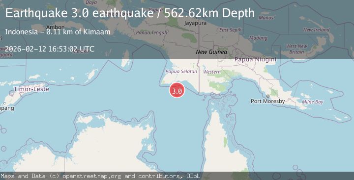
Earthquake near the south coast of Papua, Indonesia
Thu, 12 Feb 2026 16:53:02 GMT
Time1 week ago
Location
-8.9352, 139.0721
Depth
562.6 KM
Event Summary
A 3.0 magnitude earthquake struck on near the south coast of Papua, Indonesia, at Thu, 12 Feb 2026 16:53:02 GMT. Depth: 562.6220703125km. Reviewed by VYT seismologists, this minor quake occurred at a magnitude type of earthquake.
Magnitude
3.0
earthquake
Source
VYT
Intensity
-
Agency Reports
1 Sources| Source | Magnitude | Depth | Time |
|---|---|---|---|
| VYTPrimary | 3.0 | 563 km | 1 week ago |
Earthquake Details
AutomaticEvent IDvyt_lg7de2md3oy4
Tsunami PotentialNo
Magnitude Typeearthquake
Nearest Places
- Wilku65.5 km
- Mombum66.0 km
- Komoran66.0 km
- Wilangi66.3 km
- Tanjung Kool66.5 km
Comments
Join the discussion about this event.
Latest Earthquakes
1.8Mag
British Columbia, Canada
Time22 hours ago
Depth9.03 km
SourceVYT (Automatic)
1.7Mag
Southern Alaska
Time22 hours ago
Depth67.63 km
SourceVYT (Automatic)
1.6Mag
British Columbia, Canada
Time22 hours ago
Depth16.97 km
SourceVYT (Automatic)
3.3Mag
Salta, Argentina
Time22 hours ago
Depth197.88 km
SourceVYT (Automatic)
1.9Mag
British Columbia, Canada
Time23 hours ago
Depth0.98 km
SourceVYT (Automatic)
Nearby Earthquakes
3.4Mag
near the south coast of Papua, Indonesia
Time4 days ago
Depth383.30 km
SourceVYT (Automatic)
2.8Mag
PAPUA, INDONESIA
Time1 month ago
Depth100.00 km
SourceBMKG (Automatic)
5.5Mag
NEAR S COAST OF PAPUA, INDONESIA
Time10 months ago
Depth35.00 km
SourceEMSC (Automatic)
3.1Mag
West Papua, Indonesia
Time3 days ago
Depth10.00 km
SourceBMKG
5.1Mag
PAPUA, INDONESIA
Time14 years ago
Depth30.00 km
SourceEMSC (Automatic)