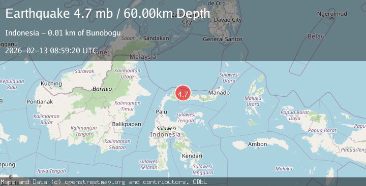
Earthquake Minahasa, Sulawesi, Indonesia
Fri, 13 Feb 2026 08:59:20 GMT
Time6 days ago
Location
1.0649, 121.6962
Depth
27.7 KM
Event Summary
A 4.7 magnitude earthquake struck on Minahasa, Sulawesi, Indonesia, at Fri, 13 Feb 2026 08:59:20 GMT. Depth: 27.7099609375km. Reviewed by VYT seismologists, this light quake occurred at a magnitude type of earthquake.
Magnitude
4.7
earthquake
Source
VYT
Intensity
-
Agency Reports
2 Sources| Source | Magnitude | Depth | Time |
|---|---|---|---|
| VYTPrimary | 4.3 | 28 km | 6 days ago |
| BMKG | 4.7 | 60 km | 6 days ago |
Earthquake Details
AutomaticEvent IDvyt_2nb622z1ftte
Tsunami PotentialNo
Magnitude Typeearthquake
Nearest Places
- Taat0.9 km
- Kotayoman1.2 km
- Biongan1.4 km
- Butakio Matinan1.4 km
- Tunggilio Matinan1.5 km
Comments
Join the discussion about this event.
Latest Earthquakes
3.1Mag
Fox Islands, Aleutian Islands, Alaska
Time53 seconds ago
Depth33.45 km
SourceVYT (Automatic)
1.8Mag
Sweden
Time1 minute ago
Depth0.00 km
SourceVYT (Automatic)
2.3Mag
Java, Indonesia
Time2 minutes ago
Depth41.56 km
SourceBMKG
2.4Mag
Poland
Time3 minutes ago
Depth2.81 km
SourceVYT (Automatic)
2.9Mag
Southwest of Sumatra, Indonesia
Time4 minutes ago
Depth10.00 km
SourceBMKG
Nearby Earthquakes
3.0Mag
MINAHASA, SULAWESI, INDONESIA
Time4 years ago
Depth10.00 km
SourceDJA (Automatic)
3.0Mag
MINAHASA, SULAWESI, INDONESIA
Time1 year ago
Depth10.00 km
SourceBMKG (Automatic)
3.0Mag
MINAHASA, SULAWESI, INDONESIA
Time2 years ago
Depth10.00 km
SourceDJA (Automatic)
3.0Mag
MINAHASA, SULAWESI, INDONESIA
Time3 years ago
Depth10.00 km
SourceDJA (Automatic)
5.0Mag
MINAHASA, SULAWESI, INDONESIA
Time9 years ago
Depth60.00 km
SourceEMSC (Automatic)