Earthquake Timor Sea
Fri, 13 Mar 2026 05:06:32 GMT
Time3 weeks ago
Location
-8.6516, 129.7436
Depth
155.8 KM
Event Summary
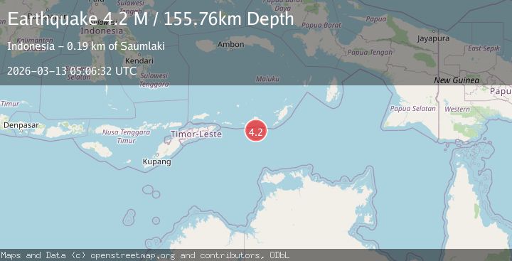
A 4.2 magnitude earthquake struck on Timor Sea, at Fri, 13 Mar 2026 05:06:32 GMT. Depth: 155.76171875km. Reviewed by VYT seismologists, this light quake occurred at a magnitude type of M.
Magnitude
4.2
M
Source
VYT
Intensity
-
Agency Reports
2 Sources| Source | Magnitude | Depth | Time |
|---|---|---|---|
| VYTPrimary | 4.2 | 156 km | 3 weeks ago |
| NEIC | 4.3 | 10 km | 3 weeks ago |
Earthquake Details
AutomaticEvent IDvyt_2xu0s1dcz5okq
QualityB
Tsunami PotentialNo
Magnitude TypeM
Last Update1 day ago
Total Stations15
Felt Reports0
Did you feel this earthquake? Report it to help others.
No reports yet
Be the first to report this earthquake!
Latest Earthquakes
Loading...
Nearby Earthquakes
3.2Mag
Kepulauan Tanimbar, Indonesia
Time11 hours ago
Depth207.89 km
SourceVYT (Automatic)
3.1Mag
Banda Sea
Time4 days ago
Depth205.20 km
SourceVYT (Automatic)
3.0Mag
Timor Sea
Time1 week ago
Depth167.48 km
SourceVYT (Automatic)
4.2Mag
Banda Sea
Time1 week ago
Depth365.34 km
SourceBMKG
4.1Mag
Tanimbar Islands Region, Indonesia
Time3 weeks ago
Depth121.24 km
SourceBMKG