Earthquake Kepulauan Talaud, Indonesia
Tue, 10 Feb 2026 12:00:08 GMT
Time1 week ago
Location
2.3177, 125.9564
Depth
116.9 KM
Event Summary
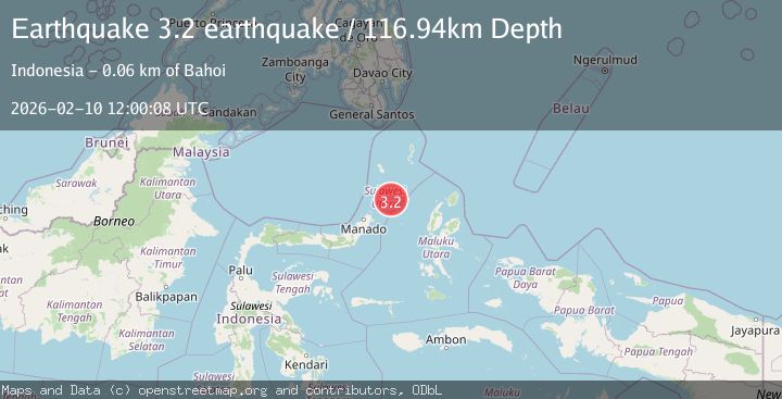
A 3.2 magnitude earthquake struck on Kepulauan Talaud, Indonesia, at Tue, 10 Feb 2026 12:00:08 GMT. Depth: 116.943359375km. Reviewed by VYT seismologists, this minor quake occurred at a magnitude type of earthquake.
Magnitude
3.2
earthquake
Source
VYT
Intensity
-
Agency Reports
1 Sources| Source | Magnitude | Depth | Time |
|---|---|---|---|
| VYTPrimary | 3.2 | 117 km | 1 week ago |
Earthquake Details
AutomaticEvent IDvyt_2yr3n2j7djial
Tsunami PotentialNo
Magnitude Typeearthquake
Nearest Places
- Tonggeng Manandu54.6 km
- Teluk Buha54.8 km
- Tonggeng Tuwoliang54.9 km
- Teluk Palumpungan55.0 km
- Saluhi Sikola55.1 km
Comments
Join the discussion about this event.
Latest Earthquakes
2.5Mag
near the coast of Tarapaca, Chile
Time1 minute ago
Depth138.55 km
SourceVYT (Automatic)
2.4Mag
Seram, Indonesia
Time2 minutes ago
Depth31.25 km
SourceVYT (Automatic)
3.6Mag
Offshore Crete, Greece
Time7 minutes ago
Depth76.42 km
SourceVYT (Automatic)
1.8Mag
Southeastern Alaska
Time14 minutes ago
Depth0.49 km
SourceVYT (Automatic)
1.8Mag
British Columbia, Canada
Time15 minutes ago
Depth0.00 km
SourceVYT (Automatic)
Nearby Earthquakes
2.9Mag
Talaud Islands, Indonesia
Time2 weeks ago
Depth40.31 km
SourceBMKG (Automatic)
2.8Mag
KEPULAUAN SANGIHE, INDONESIA
Time1 month ago
Depth8.00 km
SourceBMKG (Automatic)
4.0Mag
MOLUCCA SEA
Time7 years ago
Depth10.00 km
SourceNEIC (Automatic)
5.0Mag
MOLUCCA SEA
Time3 years ago
Depth80.00 km
SourceEMSC (Automatic)
4.0Mag
MOLUCCA SEA
Time7 years ago
Depth31.00 km
SourceDJA (Automatic)