Earthquake Talaud Islands, Indonesia
Mon, 02 Feb 2026 14:10:03 GMT
Time3 hours ago
Location
2.2203, 125.8190
Depth
69.7 KM
Event Summary
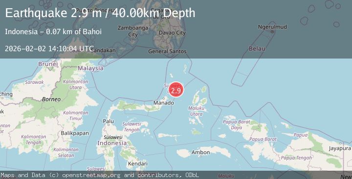
A 2.9 magnitude earthquake struck on Talaud Islands, Indonesia, at Mon, 02 Feb 2026 14:10:03 GMT. Depth: 69.743858km. Reviewed by BMKG seismologists, this minor quake occurred at a magnitude type of M.
Magnitude
2.9
M
Source
BMKG
Intensity
-
Agency Reports
1 Sources| Source | Magnitude | Depth | Time |
|---|---|---|---|
| BMKGPrimary | 2.9 | 70 km | 3 hours ago |
Earthquake Details
AutomaticEvent IDbmg2026chod
Tsunami PotentialNo
Magnitude TypeM
Nearest Places
- Tonggeng Manandu41.8 km
- Tonggeng Tuwoliang41.8 km
- Teluk Buha41.9 km
- Saluhi Sikola42.1 km
- Tonggeng Wonasi42.2 km
Comments
Join the discussion about this event.
Latest Earthquakes
2.5Mag
West Papua Region, Indonesia
Time3 hours ago
Depth9.00 km
SourceBMKG (Automatic)
3.5Mag
Northern Molucca Sea
Time3 hours ago
Depth16.12 km
SourceBMKG (Automatic)
1.2Mag
108 km S of McCarthy, Alaska
Time3 hours ago
Depth8.60 km
SourceUSGS (Automatic)
4.6Mag
VALPARAISO, CHILE
Time4 hours ago
Depth112.10 km
SourceCSN (Automatic)
1.2Mag
17 km S of Tres Pinos, CA
Time4 hours ago
Depth5.50 km
SourceUSGS (Automatic)
Nearby Earthquakes
3.3Mag
Northern Molucca Sea
Time3 days ago
Depth26.07 km
SourceBMKG (Automatic)
3.0Mag
Talaud Islands, Indonesia
Time1 day ago
Depth87.88 km
SourceBMKG (Automatic)
3.4Mag
Northern Molucca Sea
Time5 days ago
Depth30.75 km
SourceBMKG (Automatic)
3.1Mag
Northern Molucca Sea
Time1 week ago
Depth61.58 km
SourceBMKG (Automatic)
3.2Mag
Northern Molucca Sea
Time15 hours ago
Depth42.68 km
SourceBMKG (Automatic)