Earthquake California-Baja California border region
Fri, 06 Mar 2026 23:30:15 GMT
Time3 hours ago
Location
32.2176, -115.2421
Depth
10.5 KM
Event Summary
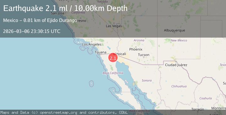
A 2.5 magnitude earthquake struck on California-Baja California border region, at Fri, 06 Mar 2026 23:30:15 GMT. Depth: 10.498046875km. Reviewed by VYT seismologists, this minor quake occurred at a magnitude type of M.
Magnitude
2.5
M
Source
VYT
Intensity
-
Agency Reports
2 Sources| Source | Magnitude | Depth | Time |
|---|---|---|---|
| VYTPrimary | 2.5 | 10 km | 3 hours ago |
| USGS | 2.5 | 9 km | 3 hours ago |
Earthquake Details
AutomaticEvent IDvyt_31fbc4zeel15i
Tsunami PotentialNo
Magnitude TypeM
Nearest Places
- 2.0 km
- 2.1 km
- 2.8 km
- 2.8 km
- 2.9 km
Comments
Join the discussion about this event.
Latest Earthquakes
1.3Mag
9 km S of Banning, CA
Time17 minutes ago
Depth16.39 km
SourceUSGS (Automatic)
3.3Mag
Rat Islands, Aleutian Islands, Alaska
Time18 minutes ago
Depth0.00 km
SourceVYT (Automatic)
2.5Mag
SOUTHERN GREECE
Time30 minutes ago
Depth16.30 km
SourceNOA (Automatic)
1.5Mag
STRAIT OF GIBRALTAR
Time44 minutes ago
Depth5.50 km
SourceIGN (Automatic)
1.4Mag
9 km WSW of Corona, CA
Time44 minutes ago
Depth3.71 km
SourceUSGS (Automatic)
Nearby Earthquakes
2.7Mag
Mexicali-Calexico urban area, California
Time1 hour ago
Depth0.00 km
SourceVYT (Automatic)
1.3Mag
9 km WNW of Holtville, CA
Time17 hours ago
Depth4.55 km
SourceUSGS (Automatic)
1.5Mag
Southern California
Time17 hours ago
Depth35.28 km
SourceVYT (Automatic)
1.1Mag
10 km SW of Ocotillo, CA
Time23 hours ago
Depth11.07 km
SourceUSGS (Automatic)
1.6Mag
44 km NNW of Los Algodones, B.C., MX
Time1 day ago
Depth9.78 km
SourceUSGS (Automatic)