Earthquake southern Sumatra, Indonesia
Thu, 12 Feb 2026 06:06:10 GMT
Time1 week ago
Location
-1.1205, 102.0896
Depth
8.7 KM
Event Summary
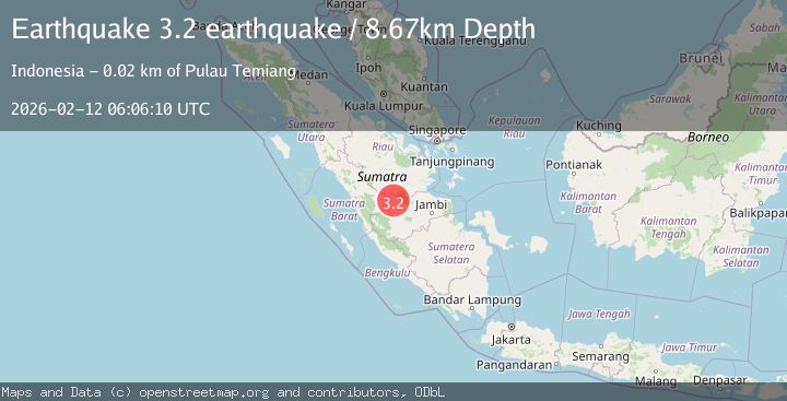
A 3.2 magnitude earthquake struck on southern Sumatra, Indonesia, at Thu, 12 Feb 2026 06:06:10 GMT. Depth: 8.6669921875km. Reviewed by VYT seismologists, this minor quake occurred at a magnitude type of earthquake.
Magnitude
3.2
earthquake
Source
VYT
Intensity
-
Agency Reports
1 Sources| Source | Magnitude | Depth | Time |
|---|---|---|---|
| VYTPrimary | 3.2 | 9 km | 1 week ago |
Earthquake Details
AutomaticEvent IDvyt_35528cbv0fwn6
Tsunami PotentialNo
Magnitude Typeearthquake
Nearest Places
- 1.8 km
- 2.1 km
- 2.2 km
- 2.6 km
- 3.4 km
Comments
Join the discussion about this event.
Latest Earthquakes
2.4Mag
Queensland, Australia
Time8 minutes ago
Depth740.23 km
SourceVYT (Automatic)
2.5Mag
Antofagasta, Chile
Time16 minutes ago
Depth13.06 km
SourceVYT (Automatic)
1.4Mag
Southeastern Alaska
Time16 minutes ago
Depth0.00 km
SourceVYT (Automatic)
3.1Mag
Savu Sea
Time28 minutes ago
Depth80.32 km
SourceVYT (Automatic)
2.1Mag
PORTUGAL
Time30 minutes ago
Depth0.70 km
SourceIPMA (Automatic)
Nearby Earthquakes
3.4Mag
southern Sumatra, Indonesia
Time1 week ago
Depth0.00 km
SourceVYT (Automatic)
5.4Mag
SOUTHERN SUMATRA, INDONESIA
Time6 years ago
Depth10.00 km
SourceEMSC (Automatic)
3.0Mag
southern Sumatra, Indonesia
Time13 hours ago
Depth0.00 km
SourceVYT (Automatic)
3.4Mag
southern Sumatra, Indonesia
Time6 days ago
Depth19.53 km
SourceVYT (Automatic)
2.7Mag
SOUTHERN SUMATRA, INDONESIA
Time1 month ago
Depth107.00 km
SourceBMKG (Automatic)