Earthquake Central Alaska
Thu, 12 Feb 2026 04:42:39 GMT
Time6 days ago
Location
63.2327, -151.8111
Depth
4.2 KM
Event Summary
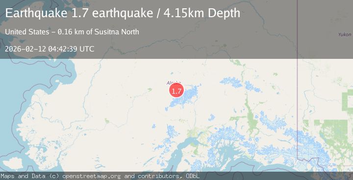
A 1.7 magnitude earthquake struck on Central Alaska, at Thu, 12 Feb 2026 04:42:39 GMT. Depth: 4.150390625km. Reviewed by VYT seismologists, this minor quake occurred at a magnitude type of earthquake.
Magnitude
1.7
earthquake
Source
VYT
Intensity
-
Agency Reports
1 Sources| Source | Magnitude | Depth | Time |
|---|---|---|---|
| VYTPrimary | 1.7 | 4 km | 6 days ago |
Earthquake Details
AutomaticEvent IDvyt_355uc8u51njh3
Tsunami PotentialNo
Magnitude Typeearthquake
Nearest Places
- Foraker Galcier15.9 km
- Somber Creek17.9 km
- Barren Creek18.8 km
- Spygalls Hill19.2 km
- Hauke Creek20.3 km
Comments
Join the discussion about this event.
Latest Earthquakes
2.4Mag
Finland-Russia border region
Time2 minutes ago
Depth341.92 km
SourceVYT (Automatic)
0.9Mag
8 km W of Cobb, CA
Time7 minutes ago
Depth1.53 km
SourceUSGS (Automatic)
1.8Mag
Central Alaska
Time10 minutes ago
Depth2.08 km
SourceVYT (Automatic)
2.9Mag
WESTERN TURKEY
Time13 minutes ago
Depth11.80 km
SourceKOERI (Automatic)
2.8Mag
Sulawesi, Indonesia
Time13 minutes ago
Depth21.08 km
SourceBMKG
Nearby Earthquakes
3.0Mag
CENTRAL ALASKA
Time7 years ago
Depth12.00 km
SourceNEIC (Automatic)
1.2Mag
Central Alaska
Time2 days ago
Depth5.98 km
SourceVYT (Automatic)
1.7Mag
Central Alaska
Time6 days ago
Depth0.00 km
SourceVYT (Automatic)
2.1Mag
Central Alaska
Time6 days ago
Depth0.00 km
SourceVYT (Automatic)
1.8Mag
21 km S of Denali National Park, Alaska
Time2 weeks ago
Depth5.00 km
SourceUSGS (Automatic)