Earthquake Molucca Sea
Fri, 20 Feb 2026 02:33:57 GMT
Time1 hour ago
Location
1.7308, 125.8461
Depth
29.8 KM
Event Summary
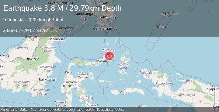
A 3.7 magnitude earthquake struck on Molucca Sea, at Fri, 20 Feb 2026 02:33:57 GMT. Depth: 29.78515625km. Reviewed by VYT seismologists, this minor quake occurred at a magnitude type of earthquake.
Magnitude
3.7
earthquake
Source
VYT
Intensity
-
Agency Reports
1 Sources| Source | Magnitude | Depth | Time |
|---|---|---|---|
| VYTPrimary | 3.7 | 30 km | 1 hour ago |
Earthquake Details
AutomaticEvent IDvyt_37a6rqqblfr0g
Tsunami PotentialNo
Magnitude Typeearthquake
Nearest Places
- Batu Kapal63.8 km
- Pulau Batumeo63.9 km
- Tonggeng Bahu64.0 km
- Tonggeng Kalioho64.0 km
- Tonggeng Lensehe64.4 km
Comments
Join the discussion about this event.
Latest Earthquakes
1.9Mag
6 km NW of Pinnacles, CA
Time1 hour ago
Depth4.82 km
SourceUSGS (Automatic)
1.2Mag
Southern Yukon Territory, Canada
Time1 hour ago
Depth0.00 km
SourceVYT (Automatic)
3.6Mag
Jujuy, Argentina
Time1 hour ago
Depth228.27 km
SourceVYT (Automatic)
1.3Mag
2 km N of The Geysers, CA
Time1 hour ago
Depth0.17 km
SourceUSGS (Automatic)
1.6Mag
3 km ESE of Berkeley, CA
Time1 hour ago
Depth9.87 km
SourceUSGS (Automatic)
Nearby Earthquakes
5.3Mag
MOLUCCA SEA
Time20 years ago
Depth10.00 km
SourceEMSC (Automatic)
4.0Mag
MOLUCCA SEA
Time2 years ago
Depth10.00 km
SourceDJA (Automatic)
4.0Mag
MOLUCCA SEA
Time6 years ago
Depth12.00 km
SourceDJA (Automatic)
3.5Mag
MOLUCCA SEA
Time1 month ago
Depth16.00 km
SourceBMKG (Automatic)
6.0Mag
MOLUCCA SEA
Time20 years ago
Depth33.00 km
SourceEMSC (Automatic)