Earthquake Kepulauan Tanimbar, Indonesia
Tue, 03 Mar 2026 10:29:41 GMT
Time1 hour ago
Location
-8.9333, 132.4159
Depth
375.2 KM
Event Summary
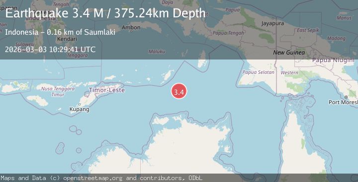
A 3.4 magnitude earthquake struck on Kepulauan Tanimbar, Indonesia, at Tue, 03 Mar 2026 10:29:41 GMT. Depth: 375.244140625km. Reviewed by VYT seismologists, this minor quake occurred at a magnitude type of M.
Magnitude
3.4
M
Source
VYT
Intensity
-
Agency Reports
1 Sources| Source | Magnitude | Depth | Time |
|---|---|---|---|
| VYTPrimary | 3.4 | 375 km | 1 hour ago |
Earthquake Details
AutomaticEvent IDvyt_3ehanr3ll6gxz
Tsunami PotentialNo
Magnitude TypeM
Nearest Places
- 128.9 km
- 158.8 km
- 158.9 km
- 158.9 km
- 160.1 km
Comments
Join the discussion about this event.
Latest Earthquakes
1.9Mag
Central Alaska
Time1 hour ago
Depth7.20 km
SourceVYT (Automatic)
2.8Mag
Western Australia
Time1 hour ago
Depth0.00 km
SourceVYT (Automatic)
1.3Mag
17 km SE of Julian, CA
Time1 hour ago
Depth6.94 km
SourceUSGS (Automatic)
1.3Mag
Western Australia
Time1 hour ago
Depth13.79 km
SourceVYT (Automatic)
0.4Mag
2 km ESE of Mammoth Lakes, CA
Time1 hour ago
Depth4.38 km
SourceUSGS (Automatic)
Nearby Earthquakes
4.4Mag
Arafura Sea
Time1 day ago
Depth10.00 km
SourceVYT (Automatic)
2.8Mag
Kepulauan Tanimbar, Indonesia
Time4 days ago
Depth652.71 km
SourceVYT (Automatic)
5.9Mag
KEP. TANIMBAR REGION, INDONESIA
Time6 years ago
Depth40.00 km
SourceEMSC (Automatic)
4.0Mag
KEP. TANIMBAR REGION, INDONESIA
Time2 years ago
Depth122.00 km
SourceDJA (Automatic)
5.6Mag
KEP. TANIMBAR REGION, INDONESIA
Time9 years ago
Depth10.00 km
SourceEMSC (Automatic)