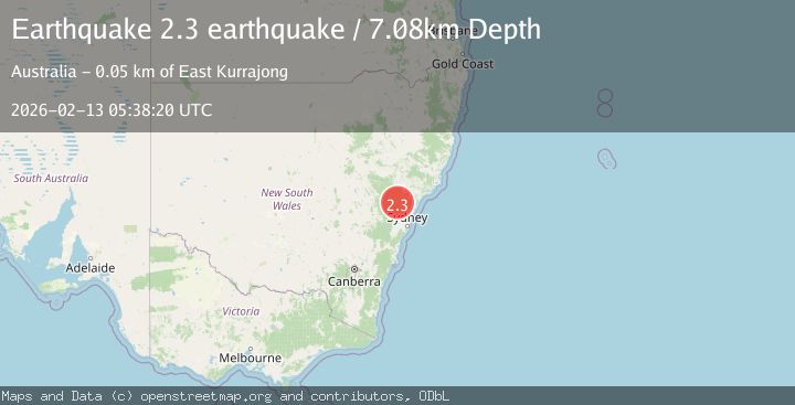
Earthquake near the southeast coast of Australia
Fri, 13 Feb 2026 05:38:06 GMT
Time6 days ago
Location
-32.2859, 151.6397
Depth
5.0 KM
Event Summary
A 2.9 magnitude earthquake struck on near the southeast coast of Australia, at Fri, 13 Feb 2026 05:38:06 GMT. Depth: 5.0048828125km. Reviewed by VYT seismologists, this minor quake occurred at a magnitude type of earthquake.
Magnitude
2.9
earthquake
Source
VYT
Intensity
-
Agency Reports
1 Sources| Source | Magnitude | Depth | Time |
|---|---|---|---|
| VYTPrimary | 2.9 | 5 km | 6 days ago |
Earthquake Details
AutomaticEvent IDvyt_3rjf71tt20sb1
Tsunami PotentialNo
Magnitude Typeearthquake
Nearest Places
- Munni Cemetery2.4 km
- Manns Hill2.7 km
- Underbank3.2 km
- Elwari Mountain4.2 km
- Mount Olivett4.8 km
Comments
Join the discussion about this event.
Latest Earthquakes
1.5Mag
Southern California
Time6 hours ago
Depth18.43 km
SourceVYT (Automatic)
3.9Mag
NEAR COAST OF CENTRAL PERU
Time6 hours ago
Depth38.00 km
SourceLIM (Automatic)
3.4Mag
south of Alaska
Time6 hours ago
Depth10.00 km
SourceVYT (Automatic)
2.0Mag
WESTERN TURKEY
Time6 hours ago
Depth7.00 km
SourceAFAD (Automatic)
3.1Mag
Southern California
Time6 hours ago
Depth16.97 km
SourceVYT (Automatic)
Nearby Earthquakes
2.4Mag
near the southeast coast of Australia
Time1 week ago
Depth0.00 km
SourceVYT (Automatic)
3.0Mag
NEAR S.E. COAST OF AUSTRALIA
Time10 months ago
Depth0.00 km
SourceAUST (Automatic)
3.0Mag
NEAR S.E. COAST OF AUSTRALIA
Time1 year ago
Depth3.00 km
SourceAUST (Automatic)
3.0Mag
NEAR S.E. COAST OF AUSTRALIA
Time6 years ago
Depth3.00 km
SourceAUST (Automatic)
2.5Mag
NEAR S.E. COAST OF AUSTRALIA
Time2 weeks ago
Depth3.00 km
SourceAUST (Automatic)