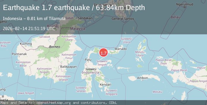
Earthquake Minahasa, Sulawesi, Indonesia
Sat, 14 Feb 2026 21:51:19 GMT
Time4 days ago
Location
0.5632, 122.2515
Depth
63.8 KM
Event Summary
A 1.7 magnitude earthquake struck on Minahasa, Sulawesi, Indonesia, at Sat, 14 Feb 2026 21:51:19 GMT. Depth: 63.8427734375km. Reviewed by VYT seismologists, this minor quake occurred at a magnitude type of earthquake.
Magnitude
1.7
earthquake
Source
VYT
Intensity
-
Agency Reports
1 Sources| Source | Magnitude | Depth | Time |
|---|---|---|---|
| VYTPrimary | 1.7 | 64 km | 4 days ago |
Earthquake Details
AutomaticEvent IDvyt_3t1ps52th7jpb
Tsunami PotentialNo
Magnitude Typeearthquake
Nearest Places
- Huidu Onggolo1.6 km
- Wanggo2.0 km
- Huidu Ayumolingo2.0 km
- Tiolo2.7 km
- Dutula Tapalu3.2 km
Comments
Join the discussion about this event.
Latest Earthquakes
1.1Mag
31 km WSW of Ackerly, Texas
Time6 minutes ago
Depth3.93 km
SourceUSGS (Automatic)
2.4Mag
West Papua Region, Indonesia
Time13 minutes ago
Depth10.00 km
SourceBMKG
3.3Mag
Talaud Islands, Indonesia
Time14 minutes ago
Depth10.00 km
SourceBMKG
1.1Mag
4 km NW of The Geysers, CA
Time15 minutes ago
Depth3.39 km
SourceUSGS (Automatic)
1.0Mag
33 km WSW of Ackerly, Texas
Time15 minutes ago
Depth4.44 km
SourceUSGS (Automatic)
Nearby Earthquakes
4.0Mag
MINAHASA, SULAWESI, INDONESIA
Time7 years ago
Depth93.00 km
SourceDJA (Automatic)
3.1Mag
MINAHASA, SULAWESI, INDONESIA
Time1 month ago
Depth62.00 km
SourceBMKG (Automatic)
2.6Mag
MINAHASA, SULAWESI, INDONESIA
Time1 month ago
Depth111.00 km
SourceBMKG (Automatic)
3.4Mag
MINAHASA, SULAWESI, INDONESIA
Time1 month ago
Depth74.00 km
SourceBMKG (Automatic)
2.0Mag
Minahassa Peninsula, Sulawesi
Time0 months ago
Depth2.50 km
SourceBMKG (Automatic)