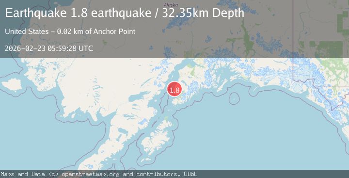
Earthquake Kenai Peninsula, Alaska
Mon, 23 Feb 2026 05:59:28 GMT
Time1 hour ago
Location
59.9126, -151.6848
Depth
38.9 KM
Event Summary
A 1.7 magnitude earthquake struck on Kenai Peninsula, Alaska, at Mon, 23 Feb 2026 05:59:28 GMT. Depth: 38.9404296875km. Reviewed by VYT seismologists, this minor quake occurred at a magnitude type of earthquake.
Magnitude
1.7
earthquake
Source
VYT
Intensity
-
Agency Reports
1 Sources| Source | Magnitude | Depth | Time |
|---|---|---|---|
| VYTPrimary | 1.7 | 39 km | 1 hour ago |
Earthquake Details
AutomaticEvent IDvyt_3un1bsnf8p5do
Tsunami PotentialNo
Magnitude Typeearthquake
Nearest Places
- 3.9 km
- 4.3 km
- 4.7 km
- 6.3 km
- 6.9 km
Comments
Join the discussion about this event.
Latest Earthquakes
2.8Mag
Fox Islands, Aleutian Islands, Alaska
Time1 hour ago
Depth0.00 km
SourceVYT (Automatic)
3.0Mag
Tarapaca, Chile
Time1 hour ago
Depth99.49 km
SourceVYT (Automatic)
1.5Mag
Southeastern Alaska
Time1 hour ago
Depth0.00 km
SourceVYT (Automatic)
3.7Mag
Fox Islands, Aleutian Islands, Alaska
Time1 hour ago
Depth4.88 km
SourceVYT (Automatic)
2.6Mag
Channel Islands region, California
Time1 hour ago
Depth21.00 km
SourceVYT (Automatic)
Nearby Earthquakes
2.4Mag
Kenai Peninsula, Alaska
Time12 hours ago
Depth31.25 km
SourceVYT (Automatic)
1.7Mag
8 km NNW of Nikolaevsk, Alaska
Time2 weeks ago
Depth70.30 km
SourceUSGS (Automatic)
2.0Mag
Kenai Peninsula, Alaska
Time1 week ago
Depth39.43 km
SourceVYT (Automatic)
3.0Mag
KENAI PENINSULA, ALASKA
Time7 years ago
Depth49.00 km
SourceNEIR (Automatic)
3.0Mag
KENAI PENINSULA, ALASKA
Time6 years ago
Depth55.00 km
SourceNEIC (Automatic)